

Destinations › West › Utah › Grand Staircase–Escalante Travel Guide
Grand Staircase–Escalante is where southern Utah stops behaving like a conventional national-park trip. There is no single entrance, no loop road collecting every attraction and no assumption that the road to a famous trailhead will be paved.
The monument covers nearly a million acres, and the best first visit starts with road conditions. In 2026, BLM visitor centers in Big Water, Escalante and Kanab provide current weather and road information, while the Cannonville Visitor Center is closed until further notice.
At a glance
| Question | Best answer |
| Best first base | Escalante |
| Southern base | Kanab / Big Water |
| Best easy-access hike | Lower Calf Creek Falls |
| Unpaved roads | Condition-dependent; ask BLM |
| Main hazard | Flash floods and remote-road problems |
| Ideal first stay | 2–3 nights |
Understanding the monument
Grand Staircase–Escalante contains plateaus, canyons, badlands, slot canyons and paleontological resources spread over an enormous area. The “Grand Staircase” refers to rising geologic steps, while the Escalante canyons form a complex drainage toward the Colorado River.
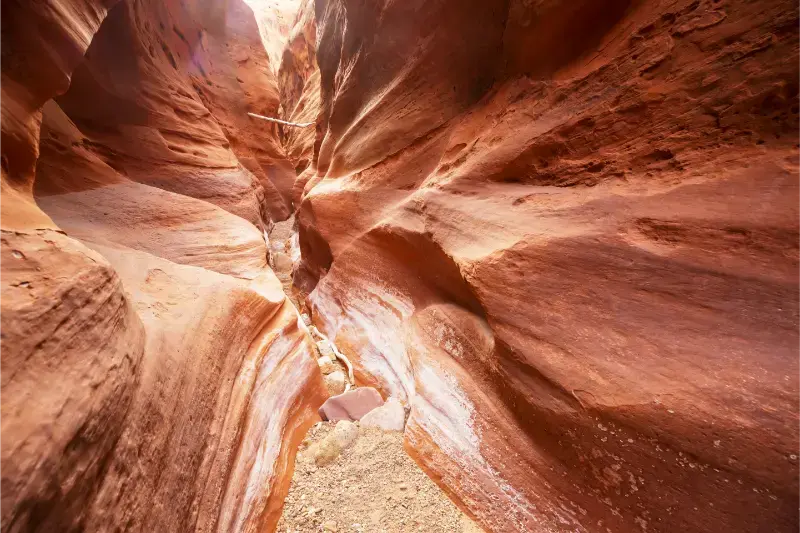
Because attractions are dispersed, a trip should focus on one subregion per day rather than trying to cross the monument repeatedly.
Start at a visitor center
The Escalante Interagency Visitor Center is the best first stop for travelers on Scenic Byway 12. Staff can provide trail, weather and road information for the northern monument. Kanab and Big Water are more useful for southern approaches.
BLM currently lists Cannonville Visitor Center as closed until further notice, so do not build a plan that depends on getting same-day road advice there.
Lower Calf Creek Falls
Lower Calf Creek Falls is one of the monument’s most approachable signature hikes from the Highway 12 corridor. The route follows a canyon to a waterfall but still requires desert-hiking preparation: heat, sun and limited shade can make the return demanding.
Start early in warm months and treat the water at the destination as scenery, not guaranteed safe drinking water.
Hole-in-the-Rock Road
Hole-in-the-Rock Road provides access to multiple desert trailheads and slot-canyon areas, but its condition varies with weather and traffic. Washboarding, mud and washouts can change the practical vehicle requirement.
Ask BLM for current information before driving. A road described as “2WD when dry” is not a promise that your rental sedan should continue after a storm.
Slot canyons and flash floods
Slot canyons concentrate water from storms that may fall far away. A blue sky overhead is not proof of safety. Check weather for the entire drainage and do not enter when flash-flood potential is present.
Technical canyons require skills and equipment far beyond ordinary hiking. Choose routes that match your experience and turn around early when conditions differ from expectations.
Cottonwood Canyon Road
Cottonwood Canyon Road can create a scenic connection between Highway 12 and U.S. 89, but it is an unpaved route that becomes problematic when wet. The northern Cannonville visitor center normally sits near one end, though it is currently closed.
Never make this road the only way to catch a flight or prepaid tour. Build enough schedule flexibility to return to paved highways if conditions deteriorate.
Burr Trail and Boulder
The Burr Trail begins near Boulder and provides one of the monument region’s most scenic paved approaches before entering more remote country. It can be integrated with Capitol Reef and the Waterpocket Fold for experienced road trippers.
The farther you continue from pavement and services, the more fuel, water and road-condition planning matter.
Two-day first itinerary
Day one: Escalante visitor center, Lower Calf Creek Falls or an easier Highway 12 hike, then sunset near Escalante. Day two: select one unpaved-road destination only after checking conditions, or stay on paved access if storms threaten.
This structure prevents the common mistake of scheduling two remote slot-canyon trailheads with no weather backup.
Three-day itinerary
Add a third day for a southern approach from Kanab/Big Water or for Burr Trail/Boulder. Do not use the extra day simply to drive farther on rough roads. Use it to explore one landscape more deeply.
A three-day stay is especially valuable for photographers because weather and light can change rapidly across the monument.
Leave no trace and cultural respect
Stay on existing roads, avoid driving on biological soil crust and pack out all waste. Remote camping does not mean impact-free camping.
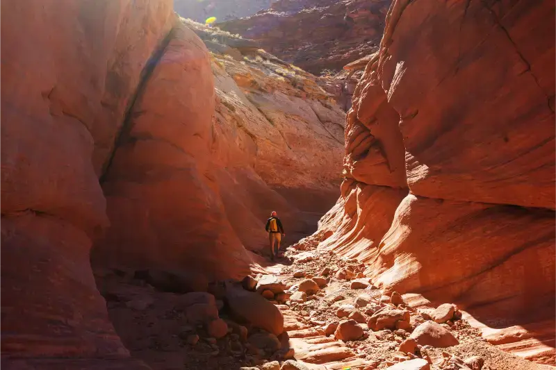
Archaeological and paleontological resources are protected. Leave artifacts exactly where they are and report significant finds rather than collecting them.
Why road conditions matter more here than mileage
Grand Staircase–Escalante is managed very differently from a compact national park. Many famous trailheads sit on unpaved roads where recent rain can matter more than the vehicle’s brand or the driver’s confidence. A road that was easy yesterday can become impassable after a storm.
Ask at a BLM visitor center before committing to remote roads, and be willing to replace a slot-canyon plan with a paved-access hike. That flexibility is part of traveling responsibly in the monument, not a failure to complete the itinerary.
Using Escalante as a base
Escalante is the most useful first-time base for the northern and central monument because it sits directly on Scenic Byway 12 and has food, lodging and an interagency visitor center. Kanab is better for the southern approach, while Boulder works beautifully for travelers combining the monument with Capitol Reef.
Choose the base from the road you intend to drive rather than from a pin on a map. Straight-line distances are misleading in canyon country.
How this guide connects with the rest of Utah
Utah trips work best as connected clusters rather than isolated attractions. Use the related guides below to compare bases, reduce backtracking and decide which experiences deserve their own day.
Practical planning strategy
Check the official land-management source again 24–48 hours before any weather-sensitive hike or unpaved-road day. Southern Utah can change quickly after storms, while northern mountain weather can alter roads and trail conditions at elevation. Download offline maps before leaving towns and never assume mobile coverage at a trailhead.
Build one priority activity per day and one backup. This simple rule prevents a permit, parking problem, heat wave or storm from ruining the entire schedule. It also gives you enough time to stop at viewpoints that were not visible when you planned the trip at home.
Frequently asked questions
Do you need 4WD for Grand Staircase–Escalante?
Not for Scenic Byway 12 and many paved-access experiences. Remote roads vary and may require high clearance or 4WD depending on conditions.
What is the best base?
Escalante is best for most first-time Highway 12 visitors; Kanab and Big Water serve the southern monument.
Is there an entrance fee?
The monument itself does not work like a gated national park, but individual recreation sites may have fees.
Can you visit after rain?
Paved areas can still be visited, but many dirt roads and slot canyons may become unsafe. Ask BLM for current conditions.
Final planning checklist
- Verify current road, trail and weather conditions.
- Download offline maps and save reservation confirmations.
- Carry more water than the minimum you expect to drink.
- Plan fuel before long scenic or backcountry drives.
- Keep at least one daily activity flexible.
- Avoid scheduling a long night drive immediately after a strenuous hike.
A final note on pacing
The most memorable Utah trips are rarely the ones with the highest attraction count. Red-rock landscapes are large, weather-sensitive and physically demanding. Give major parks and road corridors enough time for early starts, unplanned overlooks and a real meal at the end of the day. When a route feels too full on paper, removing one stop usually improves every place that remains.
For a first trip, protect sleep and daylight. Start demanding hikes in the coolest safe window, drive scenic roads while you can actually see them and reach the next lodging base before exhaustion becomes part of the plan. That approach is safer, easier for families and more likely to produce a trip you would willingly repeat.
Extra trip-planning detail
A useful way to test the itinerary is to imagine the day with a two-hour delay. If a parking queue, thunderstorm or slow restaurant would make you miss the final shuttle, reach lodging after midnight or drive an unpaved road in darkness, the plan is too tight. Add margin before the trip rather than trying to recover it on the road.
Also separate drive time from travel time. Navigation apps measure movement, not viewpoints, fuel stops, construction, wildlife, trailhead parking or the simple need to stretch after several hours in the car. In Utah, a beautiful two-hour transfer often occupies half a day once you travel at a pace that lets you experience it.
Looking for the right place to stay? Compare hotels and accommodation on Booking.com.