
Destinations › West › Nevada travel guide › Extraterrestrial Highway Road Trip: Route 375 & Area 51 Tips
Nevada’s Extraterrestrial Highway is a real remote-road trip wrapped in UFO mythology. State Route 375 crosses open basin-and-range country past themed businesses, photo signs, Rachel and roads associated with Area 51, but the experience depends more on preparation than secret sightings.
The most important rule is simple: Area 51 remains an active restricted military installation. Observe every sign, barrier and instruction, stay on legal public roads and never treat a security boundary as an attraction to test.
At a glance
| Official road | Nevada State Route 375 |
| Best length | Two days from Las Vegas |
| Main community | Rachel |
| Fuel | Plan before entering the remote corridor |
| Critical rule | Never cross restricted Area 51 boundaries |
Stops and route planning on the Extraterrestrial Highway
Begin with a prepared vehicle
Fill the tank, check the spare, carry water and download maps before leaving larger service towns. Heat, cold, wind and wildlife all matter on a road with long quiet sections.
Stop at Pahranagat National Wildlife Refuge
The refuge near Alamo can add wetlands, birds and a responsible nature stop before the UFO-themed corridor. Check federal refuge rules, road conditions and sensitive areas.
Reach Crystal Springs
The junction near State Route 375 marks the eastern approach. Use safe pullouts and do not stand in the roadway for a sign photograph.
Visit the Alien Research Center area
The themed roadside stop near Hiko establishes the playful character of the route. Verify hours and do not make food, restrooms or fuel dependent on a single small business being open.
Photograph highway signs safely
Signs may be popular targets for photographs and theft. Park fully off the travel lane where legal, remain alert to traffic and never climb or alter public infrastructure.
Find Rachel
Rachel is the closest community to the famous installation and the route’s best-known stop. It is tiny; confirm food, fuel and lodging rather than assuming urban services.
Understand the Black Mailbox
The roadside landmark is a cultural curiosity, not an official viewing platform. Stay on legal roads, respect ranch land and do not leave objects or waste.
Respect Area 51 boundaries
Public roads may lead toward clearly marked restricted areas. Stop before signs and barriers, do not photograph security personnel at close range, never fly a drone and turn around immediately when directed.
Continue west toward Tonopah
The highway connects toward U.S. 6 and Tonopah, where fuel, lodging, mining history and dark-sky opportunities support a sensible overnight. Use the Tonopah guide.
Enjoy dark skies legally
Remote darkness can be extraordinary. Choose a safe legal pullout or established location, use red light, keep the car visible and avoid driving exhausted after stargazing.
Practical planning advice
Two-day loop from Las Vegas
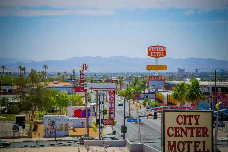
Day one can run through Alamo, Crystal Springs and Rachel before a planned overnight. Day two continues toward Tonopah and returns via U.S. 95, or becomes part of a longer Nevada road trip. Travel Nevada describes the official loop as roughly 470 miles, so it is not a casual day trip.
Do not rely on mobile service
Save confirmations, maps and emergency numbers offline. Tell someone the route and expected arrival, and avoid unplanned dirt-road detours.
Weather and road risk
Flash flooding, winter ice, extreme heat and livestock or wildlife can affect the corridor. Use Nevada 511 and reduce speed at dawn, dusk and night.
Photography and drones
Public-road photography is different from entering private or restricted land. Drone rules vary by land manager and are incompatible with military boundaries; when uncertain, do not launch.
Where to stay
Compare available accommodation for your dates, budget and preferred location before you finalize your route.
Reserve before leaving Las Vegas because rural inventory is limited. Affiliate disclosure: we may earn a commission from qualifying bookings at no extra cost to you. Compare Tonopah hotels and confirm late-arrival procedures.
Treat novelty as a theme, not a reason to take risks
UFO stories make the route memorable, but they do not change land ownership, road law or military security. The best trip collects legal roadside culture, landscapes and dark skies without chasing rumors onto unsigned tracks.
Frequently asked questions
Can I visit Area 51?
No. The installation is restricted; only legal public-road approaches and themed attractions are appropriate.
Can I drive the route in one day?
Technically possible for a limited out-and-back, but the official loop and meaningful stops are better over two days.
Is there reliable fuel on Route 375?
Services are limited and can change. Fill up before the corridor and confirm current availability.
Do I need four-wheel drive?
No for paved State Route 375. Avoid unverified dirt detours regardless of vehicle.
Is the road suitable for families?
Yes with preparation, legal boundaries and realistic expectations, but long distances and limited services require planning.
Turn priorities into a daily route
Start with Begin with a prepared vehicle and Stop at Pahranagat National Wildlife Refuge as geographic anchors rather than isolated checklist items. Put the more time-sensitive experience first, then place meals, parking and flexible stops around it. This approach leaves room for delays without sacrificing the main reason for the day. It also prevents a common Nevada mistake: accepting every apparently short detour without considering heat, one-way roads, resort walking time or the long return to the hotel.
Allow a realistic time buffer
Maps describe distance, not the complete experience of Reach Crystal Springs or Visit the Alien Research Center area. Parking searches, visitor-center stops, security, photographs and weather checks all use time. Add a buffer before any fixed reservation and avoid scheduling a nonrefundable evening immediately after a remote drive. If the day runs early, the spare time becomes a relaxed meal or viewpoint; if it runs late, the itinerary remains recoverable instead of turning into a sequence of missed bookings.
Check reservations in the correct order
Reserve scarce or regulated experiences before arranging the flexible parts of this Extraterrestrial Highway road trip plan. A cave tour, timed-entry window, headline show or limited hotel should determine the day; a scenic stop with broad access can move around it. Recheck confirmation emails for arrival instructions, parking and cancellation deadlines. Save essential documents offline because mobile coverage can weaken outside urban areas, and never assume that an entrance pass automatically includes a timed reservation or guided activity.
Build the budget from the total cost
The true price of this trip is not only admission. Include accommodation taxes and fees, parking, fuel, meals, tips, reservation charges and the cost of moving between areas. A cheaper room can become expensive when it creates several rides each day, while a rental car can be wasteful during a Strip-only stay but essential for remote Nevada. Compare the complete daily cost and the time saved, then spend more only where location, flexibility or a meaningful experience clearly improves the trip.
Prepare for Nevada distances
Before leaving a major base, confirm the next fuel stop, food option and arrival window. Keep water available in the passenger area, not buried under luggage, and download the route. On remote roads, a weak signal is normal rather than an emergency, but it becomes dangerous when travelers have not shared their plan or checked the vehicle. Avoid driving tired after sunset merely to preserve an overfilled schedule; removing one stop is always cheaper than turning a vacation into a roadside problem.
Use weather as a decision tool
Nevada weather must be read by elevation and activity. A forecast for Las Vegas does not describe Lake Tahoe or Great Basin, and an acceptable city temperature may still be unsafe on exposed sandstone. Check hourly heat, wind, thunderstorms, air quality and overnight lows. Move outdoor time earlier, shorten the route or replace it with an indoor activity when conditions deteriorate. Flexibility is not a failure of planning here; it is the skill that makes a desert-and-mountain itinerary work.
Plan for different mobility and energy levels
A mixed group should choose the day around the least mobile or least heat-tolerant traveler. Provide seated breaks, accessible alternatives and a clear meeting point instead of pressuring everyone into the same trail or resort walk. Short scenic stops can be combined with one carefully selected longer activity. Confirm accessibility directly with official sites and venues because terrain, elevators, construction and shuttle operations can change. A smaller shared plan is usually more enjoyable than separating repeatedly to chase a longer list.
Travel responsibly
Stay on durable or designated surfaces, pack out waste and never remove rocks, plants or artifacts. Petroglyphs and historic structures should be observed without touching, tracing or climbing. Keep distance from wildlife and avoid feeding it for photographs. In cities, support local businesses beyond the largest resorts when it fits the route. These choices protect the places described in this guide and also create a calmer trip, because responsible travel naturally favors slower observation over hurried collection.
Keep one backup plan
Choose an alternative for the part of the day most exposed to closure, heat, snow or sold-out parking. The backup should be nearby and genuinely appealing, not another long drive. Museums, scenic overlooks, a neighborhood meal or a shorter official trail can preserve the character of the day. Write the alternative down before departure; decision-making becomes harder when the group is tired, hungry or standing in a car park with limited reception.
Continue planning your Nevada trip
Use the Nevada travel guide as the main state hub, then compare best things to do in Nevada, best places to visit in Nevada, best time to visit Nevada and where to stay in Nevada. For a city-focused trip, continue with the Las Vegas travel guide.
Continue exploring Nevada
Use the related Nevada guides below to connect Las Vegas logistics with historic towns, rural roads and longer statewide itineraries.
- Las Vegas Strip Guide: Sights, Walking Routes & Transport
- Downtown Las Vegas & Fremont Street Guide: What to See and Do
- Las Vegas Airport Transportation: How to Reach the Strip & Downtown
- Best Day Trips from Las Vegas: 15 Realistic Excursions
- Boulder City, Nevada Travel Guide: Things to Do & Where to Stay
- Carson City, Nevada Travel Guide: History, Museums & Day Trips
- Virginia City, Nevada Travel Guide: Old West History & Attractions
- Ely, Nevada Travel Guide: Railway, Murals & Great Basin Base
- Tonopah, Nevada Travel Guide: Mining History & Dark Skies
Compare accommodation for this route
For flexible planning, compare Tonopah accommodation and Las Vegas hotels. Check the final price, mandatory fees, parking, cancellation conditions and exact map position before booking.