

North Carolina travel guide › Blue Ridge Parkway North Carolina Guide: Best Stops, Closures & Scenic Drive Strategy
The North Carolina half of the Blue Ridge Parkway contains some of the road’s highest elevations and most dramatic mountain scenery, but it is not a highway for covering distance quickly. The best trips use selected sections, leave time for overlooks and trails, and accept that weather or construction can change the plan with little notice.
In 2026 this flexibility matters more than usual. Hurricane Helene caused extensive damage in western North Carolina, and recovery work is still active in some corridors. More than 400 miles of the Parkway had been restored for use by fall 2025, but remaining North Carolina projects are scheduled through the end of 2026. Check live NPS status immediately before driving.
At a glance
| Route | Northern NC around Doughton/Boone to southern NC near Cherokee |
| Driving style | Slow scenic road with frequent stops |
| Best bases | Boone/Blowing Rock, Asheville, Cherokee |
| Best seasons | Late spring through fall, weather permitting |
| 2026 issue | Helene recovery and construction closures remain in places |
How to think about the Parkway
The Parkway is best understood as a chain of scenic segments rather than one attraction. Speed limits are moderate, curves are constant, wildlife and bicycles can slow traffic, and each overlook creates another reason to stop. A map that predicts two hours of driving can become a half day once photographs, short walks and visitor centers are included.
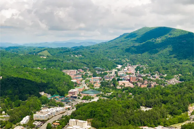
For that reason, choose a geographic section based on your overnight base. Boone and Blowing Rock are ideal for northern North Carolina. Asheville is the most flexible base for central and southern sections. Cherokee works for the final miles near Great Smoky Mountains. Trying to connect all three in a single sightseeing day defeats the purpose of the road.
Northern North Carolina: Boone, Blowing Rock and Grandfather country
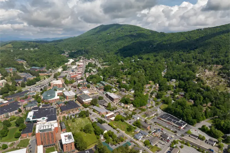
The High Country gives visitors some of the easiest Parkway access from established mountain towns. Around Boone and Blowing Rock, combine overlooks with Moses H. Cone Memorial Park, Julian Price area and nearby trails when open. Grandfather Mountain is a separate attraction accessed from regular roads, so check its tickets and hours independently.
This part of the route is especially good for travelers who want shorter scenic outings rather than a full linear drive. You can return to town for dinner, change plans if fog covers the ridge and use regular highways when a Parkway segment is closed.
Linville Falls and the recovery corridor
Linville Falls is one of the best-known names on the Parkway, but the area was heavily damaged by Helene. Recovery of visitor facilities and trails remains an active project, and the National Park Service opened a public planning process in September 2026 for longer-term restoration. Do not rely on an old guidebook’s description of parking, trail access or visitor-center services.
South of the Linville Falls area, some sections between Little Switzerland and Mount Mitchell have required full closures for major slope and road reconstruction. NPS project pages list target completion dates, but mountain construction can change. Always use the current road-status map instead of assuming a milestone date guarantees access.
Asheville corridor and southern mountain scenery
Asheville gives you multiple entry points and the ability to choose whichever section is open and best suited to the day’s weather. South of the city, the road climbs toward high-elevation forests and classic long-range views. North of Asheville, Craggy Gardens and Mount Mitchell connections are major draws when road access is available.
Fog can make a famous overlook nearly invisible while the valley below is sunny. If scenery is the goal, check the mountain forecast, not just Asheville weather. A flexible city or food day can be swapped with the Parkway when clouds sit on the ridge.
Cherokee and the southern end
The Parkway ends near Cherokee at the boundary of Great Smoky Mountains National Park. This makes Cherokee a logical overnight stop for travelers continuing into the Smokies, but remember that the Parkway and the national park have different road systems, visitor centers and current conditions.
The southern section reaches high elevations before descending toward Cherokee. Weather can be dramatically cooler than in Asheville. Carry layers even in warmer months and avoid planning the final mountain miles after dark if you are not comfortable with curves, wildlife and reduced visibility.
Best overlooks and stops: choose, do not collect
- Moses H. Cone Memorial Park area for High Country scenery and walking
- Julian Price area for lake and trail options
- Linville corridor only according to current recovery access
- Craggy Gardens when open for high-elevation views and seasonal blooms
- Mount Mitchell connection when the Parkway approach is open
- Mount Pisgah area south of Asheville
- Waterrock Knob area near the southern end when accessible
The list is intentionally selective. A good Parkway day might include four or five meaningful stops, not twenty rushed pullouts. If a parking area is full, continue to the next viewpoint rather than blocking traffic or parking on vegetation.
How far should you drive in one day?
For sightseeing, 40 to 70 Parkway miles can already fill a day when you include short hikes and meals. Longer transfers are possible, but they work better when the road itself is the main activity and you have no fixed afternoon reservation. If you need to get from Asheville to Boone efficiently, regular highways may be faster than staying on the Parkway.
Build a clear exit plan before sunset. Know which state or U.S. highway connects you back to your accommodation and download offline maps because mobile coverage is inconsistent along the ridge.
Seasonal planning and fall color
Fall color does not peak everywhere at once. Higher elevations often change first, followed by lower slopes and valleys. That can extend the viewing season, but it also creates intense weekend traffic. Weekdays and early starts are valuable during October.
Winter brings frequent weather closures and can close sections even when nearby towns are dry. Spring reopening is gradual because ice, fallen trees and maintenance can linger. In every season, the live road-status page is more useful than a generic “best month” recommendation.
Safety and low-stress driving
Do not stop in the travel lane for a photo or wildlife. Use designated overlooks and pull fully off the road. Cyclists share the Parkway, and fog can reduce visibility quickly. Fuel is not available on the Parkway itself, so begin with enough gas and food for the section you intend to drive.
The relaxed speed is part of the experience. Tailgating another visitor on a scenic road gains little and makes everyone less safe. If someone is traveling faster, use a legal overlook or pullout to let them pass.
A practical 2026 strategy
In 2026, build the day around open segments rather than a rigid list of mileposts. Check NPS road status, choose one main section, identify an alternate highway route, and make at least one backup activity in Asheville, Boone or Cherokee. That approach protects the day when construction or weather changes access.
Recovery work also affects neighboring communities, and those communities are open and welcoming visitors. Spend locally, follow signed detours and avoid entering closed work zones. A detour is not an invitation to find an unofficial shortcut on private or damaged roads.
Food, fuel and services
The Parkway has visitor facilities but is not a commercial highway. Fuel is off the road, restaurant choices are limited and some concessions operate seasonally. Fill the tank before a long section, carry water and snacks, and identify the highway exit you will use for a meal. This is especially important in 2026 when construction detours can send you farther from the planned stop. Treat visitor centers as helpful resources, not guaranteed full-service travel plazas.
Photography without creating a hazard
Many of the best photographs come from official overlooks, where you can wait for changing light without blocking traffic. Avoid walking into the road on blind curves or stopping partly in a travel lane. At sunrise and sunset, use a headlamp or reflective layer if you walk away from the vehicle. Fog and low-angle sun can make drivers less able to see pedestrians. The Parkway’s relaxed atmosphere depends on visitors resisting the urge to turn every view into an emergency stop.
Where to stay
Compare available accommodation for your dates, budget and preferred location before you finalize your route.
Choose accommodation to reduce the driving that matters for this itinerary, not simply by the lowest nightly rate. Compare accommodation in Asheville and compare the final price, parking, cancellation rules and exact map position before you book. In high season, festival weekends and peak fall-color periods, the best-located options can disappear long before the cheapest rooms.
Useful official resources
Continue planning North Carolina
These guides work well together when you want to turn the destination into a realistic route rather than a list of disconnected stops.
- Asheville travel guide
- Boone & Blowing Rock guide
- Great Smoky Mountains North Carolina guide
- North Carolina Travel Guide: Blue Ridge, Outer Banks & Cities