

Big Sur is not a town with a central square or a single attraction. It is a long, rugged stretch of California coast where Highway 1 threads between the Santa Lucia Mountains and the Pacific, passing redwood canyons, cliff-top viewpoints, state parks and a small number of lodges and restaurants. That geography is why Big Sur feels extraordinary—and why road conditions matter so much.
This Big Sur travel guide is built around a simple idea: do fewer stops, drive safely and leave enough time for the coast to feel like a place rather than a backdrop. The classic Big Sur region is often described as roughly 90 miles between Carmel and the San Simeon/Hearst Castle area, although definitions vary.
Compare available accommodation for your dates, budget and preferred location before you finalize your route.
In this guide
- 2026 road-status note
- Best time
- How long
- Essential stops
- State parks & hikes
- Where to stay
- Driving safely
- 1–2 day itinerary
- Food & services
- With kids
- Mistakes
- Closure plan
September 2026 Big Sur road-status note
Big Sur’s Highway 1 fully reopened through the Regent’s Slide project in January 2026 after years of repair work, but wildfire activity caused new closures later in the year. Caltrans reported in early September that the northern Timber Fire closure had lifted while a southern closure remained for Plaskett Fire operations. Highway-condition reporting on September 11 still showed a closure near Kirk Creek and one-way traffic control near Rocky Creek Bridge.
This is exactly why a Big Sur article should never promise that the through-route will be open on your travel date. Check Caltrans QuickMap immediately before the drive and again on the morning of travel if weather or fire conditions are active.
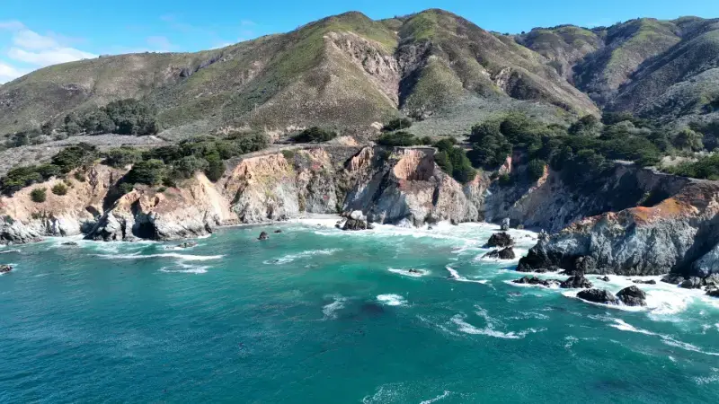
Best time to visit Big Sur
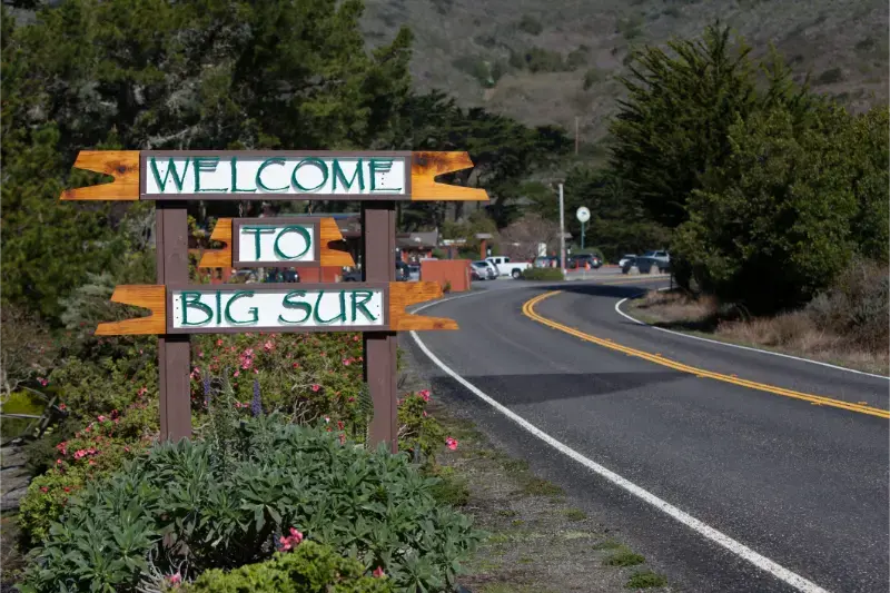
Spring brings green hills and waterfalls but can also bring rain and road instability. Summer usually offers drier weather but also fog, traffic and high hotel demand. September and October can be beautiful with somewhat clearer coastal conditions, although wildfire risk can affect air quality and access. Winter is quieter and dramatic but storms can trigger slides and closures.
There is no month that eliminates road risk. Choose the season for your priorities, then keep the itinerary flexible enough to absorb a closure or foggy morning.
How long should you spend in Big Sur?
- Half day: possible from Carmel, but limits hiking and encourages rushed stops.
- 1 full day: enough for viewpoints + one state park/hike.
- 1 night: dramatically better because you gain sunset, evening quiet and an early start.
- 2 nights: ideal for a slower first visit with redwoods, hiking and coastal time.
Do not measure Big Sur by mileage. Forty miles can take most of a day once you add parking, viewpoints, trail time and slow traffic.
Essential Big Sur stops
Bixby Creek Bridge
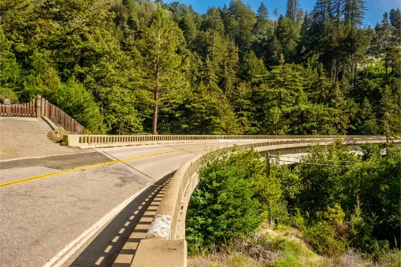
Bixby Bridge is iconic, but it has become a safety and congestion problem when visitors stop illegally, make U-turns or step into traffic. Use legal parking only, do not stop on the bridge and be willing to skip the photo if the safe areas are full. The bridge is beautiful from the road even without a staged viewpoint stop.
Point Sur and the northern coast
The volcanic-looking Point Sur landmark and open coastline south of Carmel signal the transition into Big Sur. Guided access to Point Sur State Historic Park operates on specific schedules; it is not a casual drop-in attraction.
Pfeiffer Big Sur State Park
Pfeiffer Big Sur State Park brings you into redwood forest along the Big Sur River, providing a different experience from exposed ocean cliffs. It is one of the best places to slow down for hiking, a picnic or an overnight campground stay when available.
Pfeiffer Beach
Pfeiffer Beach is famous for rock formations and dramatic surf, but access is via a narrow road with limited parking that can fill. It is not the same as Pfeiffer Big Sur State Park. Confirm access conditions and do not attempt the road with an unsuitable oversized vehicle.
McWay Falls / Julia Pfeiffer Burns State Park
McWay Falls is one of California’s signature coastal views. Trail access has changed over time because of storm damage and construction, so check California State Parks for the currently open viewing area rather than relying on an old map or photo caption. The beach itself is not a legal swimming destination.
Ragged Point and the southern approach
Ragged Point is a useful transition between Big Sur and the San Simeon/Cambria area. When Highway 1 is open through the coast, the southern section becomes increasingly remote before reconnecting with more services.
State parks and hikes worth choosing
- Andrew Molera State Park: trails, river/coast access and open landscapes; conditions vary seasonally.
- Pfeiffer Big Sur State Park: redwoods and river-valley hiking.
- Julia Pfeiffer Burns State Park: McWay Falls area and coastal scenery; verify trail status.
- Limekiln State Park: redwoods, history and coast; access has been affected by closures in past years, so check current status.
- Point Lobos State Natural Reserve: technically north of Big Sur near Carmel, but one of the best coastal walking areas to combine with the route.
Pick one or two parks rather than trying to stop at all of them. Parking fills, trail conditions change and the coast is more satisfying when you actually walk somewhere.
Where to stay
Staying inside Big Sur gives you the rarest experience: evening and early morning after day-trippers thin out. Accommodation ranges from campgrounds and rustic cabins to extremely expensive luxury properties. Supply is limited, so popular dates require early booking.
Carmel and Monterey are the most practical northern bases, with many hotels and restaurants. Cambria and San Simeon work from the south. If the highway is closed somewhere in the middle, these bases can become two separate access points rather than a through-route—another reason flexible reservations matter.
Compare accommodation: compare hotels and other stays on Booking.com.
Driving Big Sur safely
- Drive at a speed that matches curves, visibility and traffic—not the impatience of the car behind you.
- Use turnouts when safe to let faster traffic pass.
- Never stop in a travel lane for a photo.
- Do not make U-turns around Bixby Bridge or other crowded viewpoints where prohibited or unsafe.
- Fuel before remote stretches and do not rely on continuous cell service.
- Use Caltrans information for closures; do not follow navigation apps onto unapproved local detours.
A realistic one-day Big Sur itinerary
- Leave Carmel/Monterey early.
- Point Lobos or a short northern-coast stop.
- Bixby Bridge only if legal parking is available.
- Pfeiffer Big Sur State Park or another meaningful hike.
- Lunch in Big Sur—reserve if a specific restaurant matters.
- McWay Falls viewpoint if access is open.
- Continue south toward Cambria/San Simeon only if Highway 1 is fully open; otherwise return north.
With two days, stay overnight in Big Sur and use the second morning for a longer trail or Pfeiffer Beach. The extra night removes pressure to turn every pullout into a race against sunset.
Food, fuel and services are limited
Big Sur has memorable restaurants and lodges, but it is not a continuous strip of services. Opening hours can vary and cell coverage is inconsistent. Carry water and snacks, fuel before the remote section and do not assume you can spontaneously find dinner at 9 p.m. in the same way you would in San Francisco or Los Angeles.
Big Sur with kids
Families can enjoy redwood walks, beaches and viewpoints, but roadside cliffs and traffic require close supervision. Choose one easy trail, one picnic stop and one beach or viewpoint rather than a long chain of car exits. Pfeiffer Big Sur State Park is often easier with children than a day dominated by cliff-edge pullouts.
Common mistakes
- Treating Big Sur as a 90-minute transit segment between San Francisco and Los Angeles.
- Stopping illegally at Bixby Bridge.
- Assuming “Pfeiffer” always means the same park/beach.
- Booking a fixed through-route without checking Highway 1 conditions.
- Trying to visit every state park in one day.
- Running low on fuel or arriving without food/water.
- Walking beyond closure barriers because an old blog photo shows a trail as open.
What to do when Highway 1 is closed
A closure in central Big Sur can split the coast into northern and southern access zones. From the north, visit Carmel, Point Lobos and open Big Sur areas as an out-and-back. From the south, use Cambria/San Simeon and open Highway 1 sections. To continue between Northern and Southern California, use US 101 inland.
Do not think of a closure as a reason to cancel the entire California trip. It changes the road-trip geometry, not the existence of the coast.
Official planning resources
- Caltrans QuickMap — current Highway 1 conditions.
- Caltrans Highway Conditions — official restriction reporting.
- Visit California – Big Sur — official state tourism guide.
- California State Parks — current park and trail information.
Keep planning California
Big Sur is the centerpiece of our Pacific Coast Highway road trip. Combine it with San Francisco to the north and Los Angeles farther south, or return to the California travel guide for broader statewide planning.
Big Sur photography and viewpoint etiquette
The coast creates endless photo opportunities, but the best viewpoint is never worth blocking traffic. Pull completely off the roadway only where parking is legal, keep children on the protected side of the vehicle and avoid walking along narrow shoulders. Fog can erase the horizon and then reveal it minutes later, so patience is often more productive than driving to another crowded pullout.
Camping in Big Sur
Camping can make Big Sur much more affordable and gives access to quiet mornings, but developed sites are limited and popular dates sell early. Reserve through the official park or campground system and verify fire rules. Never treat roadside pullouts as informal campsites; overnight parking and dispersed camping restrictions exist to protect residents, visitors and the landscape.
Wildlife and ocean safety
Sea otters, whales, condors and other wildlife may be visible from the coast. Use binoculars rather than approaching animals. Beaches can have strong surf, cold water and sneaker waves; a scenic cove is not automatically safe for swimming. Follow posted closures and keep a generous distance from cliff edges, especially after rain.
Big Sur as a destination, not just a road
The biggest upgrade you can make is psychological: stop thinking of Big Sur as the space between Carmel and Cambria. One night turns it into a destination. You can hike in redwoods, watch changing fog, eat without checking the clock and begin the next morning before the heaviest traffic arrives. That slower pace is the reason the coast stays memorable long after the bridge photos are forgotten.