

A Grand Canyon hike begins with an unusual temptation: the easy direction comes first. You step below the rim, the walls rise around you, and the next bend seems close enough to justify going a little farther. The climb back is already part of the decision, even when you have barely noticed the descent.
The right trail is the one that fits your group, the weather, and the current access situation. For some visitors that means a selected section of Rim Trail. Others can plan a short below-rim outing, while experienced hikers may consider a longer journey with much more preparation. This guide separates those choices and explains why familiar destination names are not, by themselves, a hiking plan.
The access check comes before the trail choice
Current closures substantially limit the usual options. On October 18, 2026, NPS Key Hiking Messages lists Bright Angel open from the rim to Mile-and-a-Half Resthouse, with the section toward Havasupai Gardens closed through October 22. North Kaibab and Phantom Ranch are closed, as are the river bridges and South Kaibab below the Tip-Off. Do not plan a rim-to-rim crossing from an older route description.
There is an important distinction between a trail being listed open and it being a suitable objective. South Kaibab’s open section extends much farther than most first-time day hikers should consider. Likewise, a point shown open beyond a closed approach does not create a continuous legal route to it. Read the full closure map and ask park staff about any uncertainty before setting out.
Water information also changes. Carry what your planned outing requires and do not rely on a seasonal faucet working. The bulletin at this check lists inner-canyon water shutoffs, including Bright Angel resthouses. Check the latest trailhead notices as well. An old photograph of a water station or a general statement that a trail has water is not enough to build a safe plan around it.
Rim Trail: scenery without committing to a canyon descent
The Rim Trail is the most adaptable starting point for many visitors. It follows the South Rim across a long distance, but you can choose a short section instead of attempting the full route. Around Mather Point and Yavapai, the landscape stays broad and the view shifts as you walk. You can turn back before the outing becomes too much.
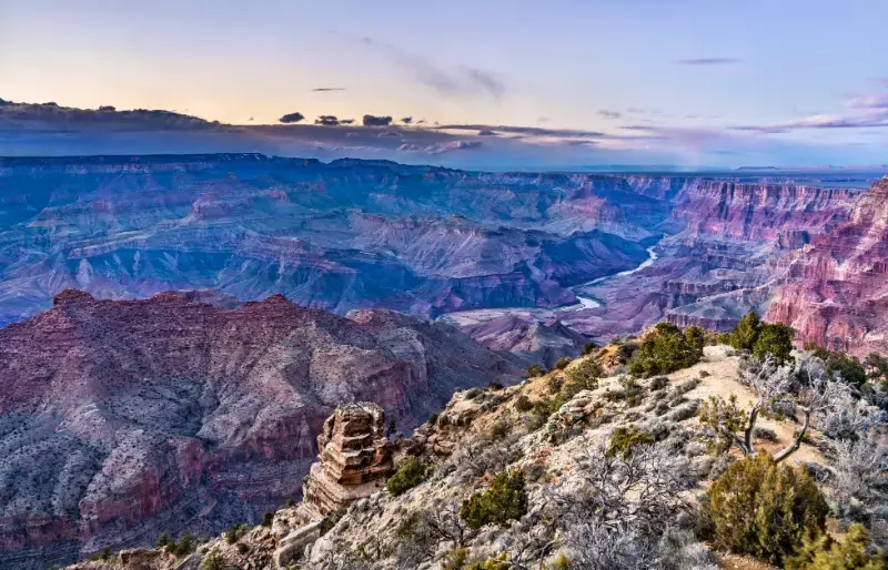
The NPS Rim Trail description identifies a mostly paved route of roughly thirteen miles in total. That overall figure should not be mistaken for a uniform accessible promenade. Surfaces, grades, exposure to the edge, and the availability of nearby facilities vary. Select the specific section that suits your needs, particularly with a wheelchair, stroller, or someone who needs frequent seated breaks.
Shuttles can support a one-way rim walk when the relevant route is operating. Check the stop locations, travel direction, and final service before leaving the starting point. For families, this can create a satisfying outing without an extended return on foot. Keep a shorter version ready in case of heat, weather, or a bus queue that changes the day’s rhythm.
South Kaibab to Ooh Aah Point: short mileage, real effort
South Kaibab descends along an exposed ridge, opening views early in the hike. Ooh Aah Point is a commonly discussed first turnaround, with the official trail information listing 1.8 miles round trip and roughly 790 feet of elevation change. Those numbers describe a steep return, not a casual level stroll. Loose footing, heat, wind, or ice can make the route more demanding.
There is no water along South Kaibab, and shade is limited. Carry your supplies from the start and organize transport before the hike. The trailhead does not have public parking; visitors normally reach it by the appropriate shuttle or another permitted arrangement. Check the current service rather than assuming you can drive to the start just before dawn.
Ooh Aah Point is an option, not an obligation. A shorter descent can still give you the experience of being below the rim. Agree on a turnaround time before starting and return earlier if anyone is struggling. When the footing requires attention, stop in a suitable place to enjoy the view instead of walking while concentrating on a camera or phone.
Cedar Ridge and Skeleton Point: a larger commitment
Cedar Ridge extends the South Kaibab outing to about three miles round trip with around 1,120 feet of elevation change. It can suit prepared hikers in appropriate conditions, but it changes the day significantly compared with a brief descent. You have more uphill ground to recover, a longer exposure to the weather, and fewer easy ways to shorten the return once you have continued downward.
Skeleton Point is a substantially harder objective, approximately six miles round trip with around 2,040 feet of elevation change. It should not be presented as the standard next step for anyone who reaches Cedar Ridge comfortably. Compare it with recent experience on steep sustained climbs, the forecast, the group’s pace, and the supplies each person can carry. A fit companion cannot make the route appropriate for everyone else.
Avoid treating the Tip-Off as a casual extension because the current bulletin lists the trail open that far. The distances and return effort grow considerably. For a first canyon visit, a shorter selected hike often fits better with transport, recovery, and the following day’s travel. Leaving energy for the rest of the trip is a useful planning goal in its own right.
Bright Angel: a different setting, with the closure respected
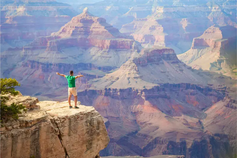
Bright Angel begins near the village and follows a side canyon rather than South Kaibab’s ridgeline. The enclosing walls give the upper section a different feel, with switchbacks drawing you downward through the rock. Its popularity and convenient starting point do not remove the effort of climbing back to the rim.
A smaller outing can use a conservative turnaround well before the current limit. The trail's general description gives distances for several destinations, but its older access and water text must be read alongside the newer closure bulletin. At this review, the section beyond Mile-and-a-Half Resthouse toward Havasupai Gardens is unavailable. Do not plan a Three-Mile Resthouse hike until the park confirms that access has reopened.
Even the Mile-and-a-Half destination means roughly three miles round trip and a significant climb out. It is not the minimum needed to experience the trail. With a mixed group, choose a shorter common outing or organize different plans before beginning. Do not leave a tired traveler waiting alone on a hot, exposed route while everyone else continues to a named point.
Why the North Rim is not a substitute hiking menu
North Rim recovery has removed many familiar choices from current planning. The North Rim status page lists Bright Angel Point, Widforss, Transept, and Uncle Jim among closed routes, alongside North Kaibab. Scenic-road work also affects access to several trailheads during the current autumn period. A trail marked open on a list may still be reached by a road that is temporarily closed.
If you visit the North Rim, use its current pocket map and ask specifically which legal routes are accessible that day. Do not follow an old online itinerary into a burn scar or around a barrier. A short visit to an available public area may be the right scope. Recovery creates a changing environment, and a saved GPS track cannot confirm that the ground is safe or open.
The North Rim also needs its own overnight and transport plan. It is not a nearby alternative that you can substitute after finding a South Rim trail closed. If hiking is the central purpose of your holiday, investigate current options before committing to that region. For many first-time trips, the South Rim’s adaptable walking choices provide a more practical framework.
Heat, cold, and the forecast below the rim
Check conditions for the place you will hike, not only the town where you sleep. Temperatures rise as you descend, and an agreeable morning at the rim can coexist with much hotter conditions lower down. In summer, NPS advises avoiding hiking during the hottest hours, from 10 a.m. to 4 p.m. An early start must still include a realistic return before dangerous conditions develop.
Winter brings another challenge: shaded trail sections can retain snow or ice after nearby roads look clear. Suitable traction, clothing, and experience may be necessary, and turning around can be the sensible choice. Ask about the actual upper trail before starting. A clear view from the rim does not tell you whether the switchbacks below it have safe footing for your equipment and ability.
Thunderstorms and wind can alter plans in other seasons as well. Follow forecasts and park instructions rather than assuming the canyon will offer an easy escape from exposed terrain. Do not shelter your itinerary from change at the expense of the group. A rim day with interpretation and short walks remains a rewarding alternative when a descent is unsuitable.
Prepare for the return while you are still at the top
Carry food, appropriate water, weather layers, sun protection, a map available offline, a headlamp, and the essentials for the route you have chosen. Each traveler should have access to their own necessary supplies. Check the Hike Smart guidance for preparation and current advice rather than applying one fixed water quantity to every person, season, and distance.
A phone is useful, but it is not the whole emergency plan. Tell someone your intended route and expected return, understand the area’s communication limitations, and know how to seek assistance. If someone becomes unwell, stop the outing and respond to the situation rather than continuing toward the planned turnaround. For severe symptoms or an emergency, seek urgent help; do not expect a rapid rescue to be guaranteed.
Pace the hike around the slowest comfortable member of the group. Take breaks in suitable places, eat, and review the return while everyone still has reserves. Keep the party together unless you have made a clear, appropriate arrangement in advance. The easiest moment to shorten a hike is before tiredness turns into a problem on the climb.
Overnight hiking belongs in a separate planning process
A night below the rim can be an exceptional goal, but it requires more than adding a campsite to a sightseeing itinerary. Consult the backcountry permit information, understand the application process, and choose a route that is open and within the group’s ability. Camping permissions, lodging reservations, trail access, and water conditions are separate matters.
At present, Phantom Ranch and the river crossings are closed, so older multi-day corridor plans cannot be assumed workable. A permit or reservation does not override a closure. If you have an existing booking, communicate with the relevant office or operator and keep their current instructions with your trip details. Avoid inventing an alternative route around a damaged or restricted section.
For a first visit, a short well-planned hike may be all you need. You can feel the scale change below the rim, return with enough energy to enjoy lunch, and spend the afternoon looking at the route from above. A successful day ends with everyone back comfortably, carrying a clearer sense of the canyon rather than a distance achieved at any cost.
Compare the options
| Choice | What it offers | Planning detail |
|---|---|---|
| Rim Trail segment | Flexible distance without a canyon descent | Surface and grades vary |
| Ooh Aah Point | 1.8 miles round trip; steep return | Exposed South Kaibab route |
| Cedar Ridge | 3 miles round trip; larger commitment | No water along South Kaibab |
| Bright Angel upper route | Conservative turnaround within open access | Use current closure bulletin |
Find your bearings
Open the map in a new tab · Orientation map; use the official local map for trail access and closures.
Frequently asked questions
Is a short below-rim hike automatically easy?
No. The climb out, footing, exposure and weather can make short distances demanding.
Should a first-time visitor hike to the river and back in one day?
No. NPS advises against a rim-to-river-and-back day hike, and current closures also prevent usual river access.
Does a camping permit override a trail closure?
No. Permits, reservations and legal trail access are separate requirements.
Plan the next part of your trip
- Grand Canyon National Park Travel Guide: South Rim, North Rim & Planning Tips
- Grand Canyon South Rim Guide: Viewpoints, Shuttle, Trails & Where to Stay
- Best Time to Visit Arizona: Month-by-Month Weather & Trip Guide
Arrange your stay and activities
Some booking links below are affiliate links. We may earn a commission if you book through them.
Compare stays: Grand Canyon hikingBrowse tours and experiencesCompare rental cars
Match the location, meeting point and cancellation terms to your itinerary before booking.
Official sources and visitor information
- Grand Canyon: October 15, 2026 trail closures and water bulletin
- Grand Canyon: Rim Trail sections and surface
- Grand Canyon: South Kaibab distances, terrain and access
- Grand Canyon: Bright Angel route description; read with newer closure bulletin
- Grand Canyon: current North Rim recovery and seasonal access
- Grand Canyon: Hike Smart preparation
- Grand Canyon: backcountry camping permit process
Last updated: October 18, 2026.