

Grand Teton National Park has more than 250 miles of trails, from short lakeshore walks to demanding alpine routes. The hardest part of planning is not finding a beautiful hike; it is matching your fitness, weather window, parking strategy and current access conditions to the right trailhead.
That last point is especially important in 2026. Grand Teton is in the middle of major infrastructure work. The National Park Service reports Death Canyon Road and Trailhead closed, construction affecting Moose–Wilson Road, and a closure on the north side of the Taggart Lake Trail. Treat old hiking itineraries as ideas, not instructions, and check current conditions the evening before every trail day.
Start with a short lake walk if you are new to the Tetons
Jenny Lake, String Lake, Leigh Lake and Colter Bay all offer ways to experience the park without committing immediately to a major climb. Shorter lakeshore walks are also useful on arrival day, when altitude, jet lag or a long drive can make a supposedly easy hike feel harder than expected.
Choose the trail by location as much as by mileage. A short walk near where you are staying can be more enjoyable than driving across the park to reproduce a famous social-media image. Early starts improve parking and give you cooler temperatures.
Taggart Lake requires special attention in 2026
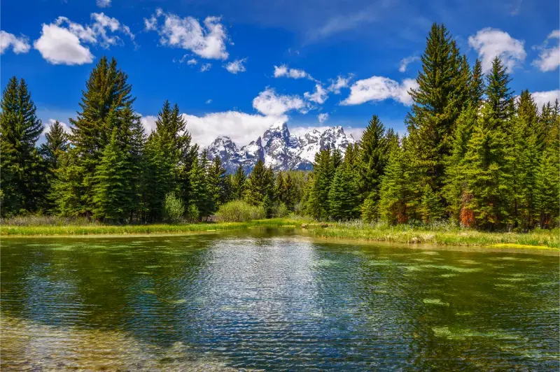
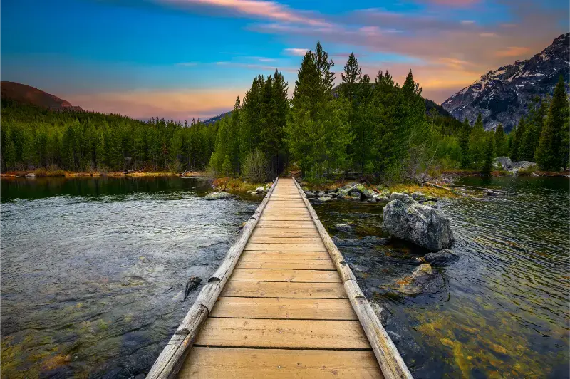
Taggart is normally one of the park’s most popular moderate hikes, but construction has changed the usual route. The National Park Service states that the north side of the Taggart Trail is closed for reconstruction during the 2026 season, while access remains available from the south on a longer, steeper route.
Do not follow an old GPS track through the closed segment. Use current NPS maps and trailhead signs, and build extra time into the day. Construction can also affect parking flow even where a trail remains open.
Death Canyon access is also changed by construction
Death Canyon Road and the traditional trailhead are closed during the 2026 project, with access to destinations beyond still possible from alternative trailheads such as Granite Canyon. That makes familiar mileage estimates obsolete for some routes and can add substantial distance to a backcountry day.
If Death Canyon is the reason for your trip, speak with a ranger before committing. A route that was moderate from the old trailhead can become a much larger objective when approached from elsewhere.
Cascade Canyon remains a classic full-day objective
The Jenny Lake area provides access toward Hidden Falls, Inspiration Point and Cascade Canyon. Hikers can use the seasonal boat service when operating or walk around the lake, changing both mileage and timing. Once in the canyon, the scenery becomes progressively more alpine, with wildlife and weather requiring increasing attention.
Lake Solitude is a much larger day than simply reaching Inspiration Point. Do not combine destinations because they appear on the same map. Turn around based on time, weather and energy rather than the desire to reach a named endpoint.
Paintbrush Canyon and high routes demand alpine judgment
Long routes into Paintbrush Canyon, Holly Lake, Paintbrush Divide or multi-day backcountry zones involve elevation, snowfields, exposure and fast-changing weather. Conditions can remain wintry well into summer at high elevations even when Jackson is warm.
Overnight backcountry camping requires a permit in Grand Teton. For ambitious routes, check trail conditions, snow information and permit rules directly with the park rather than relying on a generic hiking app.
Parking and start time are part of the hike
Popular trailheads can fill early, especially in July and August. A 6 a.m. start may solve both parking and thunderstorm problems, while a late-morning arrival can create a long parking search before the first mile. Use the park map to identify backup trailheads before you leave the hotel.
The 2026 construction around Moose, Moose–Wilson Road and some trailheads adds another layer. Allow extra driving time and avoid scheduling a fixed dinner reservation immediately after a long hike.
Where to stay
Compare available accommodation for your dates, budget and preferred location before you finalize your route.
Jackson has the largest range of hotels and restaurants but adds driving for northern park hikes. Teton Village is useful for the southwest side of the park and some trail access. In-park lodging reduces dawn driving but books early. Colter Bay and the northern lodges work well if your hiking plan focuses on Jackson Lake or if Yellowstone is next.
Affiliate disclosure: we may earn a commission from qualifying bookings at no extra cost to you. Compare places to stay on Booking.com. Check the map location, parking, cancellation terms and the next morning’s driving time before booking.
Best time to visit
July through September is the most reliable window for high-elevation hiking, though snow can linger and early storms can arrive in September. June offers long days but more snow and water on upper trails. October can be beautiful at lower elevations while high routes become much less predictable. Winter hiking is a different activity requiring snow travel skills.
Driving, weather and safety
Carry bear spray where it is recommended, make noise in limited visibility and store food correctly. Start exposed hikes early to reduce thunderstorm risk. Bring more water and warm clothing than the temperature in Jackson suggests. Never enter a construction closure, even if an old map or trail app still shows the route.
Wyoming rewards conservative schedules. Distances between towns are large, mountain weather can change within one drive and wildlife can slow traffic without warning. Keep fuel above a comfortable reserve, download maps before leaving reliable service and avoid making an evening hotel check-in depend on perfect road conditions.
Before a remote day, check Wyoming 511 plus the official park, forest or historic-site page for the exact destination. A road can be open while a trailhead, campground, visitor center or connecting pass is closed. Saving those pages offline is useful when cellular service disappears.
How this stop fits into a Wyoming itinerary
Use the main Grand Teton National Park guide for park-wide logistics and Jackson Hole for lodging and town planning. If your route continues north, the Yellowstone guide and wildlife-watching guide make a natural next step.
For the broader picture, use the Wyoming travel hub to compare regions before adding another long transfer. A good Wyoming road trip usually has fewer bases than first-time visitors expect, with two or three nights in places where weather or wildlife can change the day.
Practical pacing for this part of Wyoming
Do not measure a visit to Grand Teton Hiking only by attraction count. The most useful schedule leaves room for a slower meal, an unexpected overlook, a ranger conversation or a weather delay. Start the day with the activity that is most sensitive to parking, heat or thunderstorms, then keep the afternoon flexible. This approach is particularly valuable in Wyoming because the distance to the next town can be much greater than it appears when reading a list of stops.
If you are combining this stop with a national park, resist the urge to place a major hike, a long scenic drive and a multi-hour transfer on the same day. Choose one primary experience and one secondary stop. That keeps children and adults fresher, gives wildlife traffic less power over the schedule and makes it easier to change plans when a road or trail is temporarily unavailable.
Carry a paper or downloaded map even if you normally navigate by phone. Save the address of your lodging, the nearest fuel stop and at least one alternate route before leaving town. When a storm, wildfire response or construction closure changes access, having those basics available offline is more useful than trying to rebuild the day from a weak signal beside the road.
Small choices that make the visit better
For Grand Teton Hiking, the difference between a rushed stop and a satisfying visit is usually one extra hour rather than one extra attraction. Arrive with enough daylight to orient yourself, identify the next fuel or food stop and understand the road you will use when leaving. If the destination has a visitor center or ranger desk, ask what has changed recently; local closures, water levels, construction and seasonal services can matter more than a generic itinerary written months earlier.
Build meals into the route instead of assuming a restaurant will appear exactly when everyone is hungry. Small Wyoming communities may have limited hours, especially outside summer weekends. Carry water and a simple backup meal, then use local cafés and stores when they fit naturally. This keeps a delayed hike or wildlife stop from turning into an unnecessary rush toward the next town.
Finally, leave one optional item on the schedule. If weather stays good, use it for a short trail, museum, overlook or evening walk. If conditions deteriorate, drop it without feeling that the trip failed. That flexibility is one of the most useful habits in a state where high elevation, wind and long distances can change the pace of a day very quickly.
Frequently asked questions
What is the best easy hike in Grand Teton?
There is no single best choice, but String Lake, Leigh Lake and Colter Bay offer relatively gentle options. Choose based on current conditions and where you are staying.
Is Taggart Lake open in 2026?
The area remains accessible, but the north side of the Taggart Trail is closed for reconstruction. Follow the current NPS route from the south and verify conditions before hiking.
Is Death Canyon Trailhead open?
No. The National Park Service lists Death Canyon Road and Trailhead closed during 2026 construction. Alternative approaches make routes longer.
Do I need a permit for day hiking?
Ordinary day hiking does not require a backcountry camping permit, but overnight backcountry trips do. Some special activities have separate permit rules.