

Badlands National Park rewards people who understand that the road is part of the park. The paved Badlands Loop Road places overlooks, trailheads and layered formations close together, while Sage Creek Rim Road adds grassland, wildlife and a rougher edge. The temptation is to stop at every pullout, but a better visit alternates driving with a few carefully chosen walks and protects early or late light.
The park is also easier to visit than many famous western national parks: no shuttle is required and the North Unit can be crossed as part of an I-90 road trip. That accessibility can lead to overconfidence. Cell service varies, summer heat is serious, winter roads can close, and Sage Creek Rim Road may become unsuitable after heavy rain or snow. A flexible plan is more useful than a minute-by-minute schedule.
- Best base: Wall for road-trip convenience; Interior or park lodging/camping for first and last light
- Realistic time: One full day is strong; one night nearby makes sunrise or sunset far easier
- Best for: Scenic drivers, photographers, short-hike travelers, families and first-time national-park visitors
- Main planning risk: Driving the Loop at midday, stopping at every overlook and assuming gravel roads are always passable
- Best route pairing: Wall and I-90 to the north; Rapid City about 75 miles west
Is it worth adding to a South Dakota trip?
Badlands is one of the highest-value detours in the Great Plains because the landscape changes abruptly and the main paved route can fit naturally between Wall and Rapid City. Even travelers who do not hike much can experience major scenery from overlooks and short boardwalks. The park becomes substantially better, however, if you spend at least a few hours outside the car.
If you have only two hours, drive a focused section of the Loop Road and pick one short trail rather than trying to reach Sage Creek as well. If you have a full day, add Door/Window/Notch or another trail that matches your ability, the Ben Reifel Visitor Center and wildlife time. The western grassland side feels different enough that it deserves space rather than a rushed final drive.
What to do — and how to prioritize it
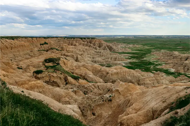
Drive Badlands Loop Road with selective stops
Highway 240 is the backbone of a first visit. Instead of stopping at every overlook, choose a few viewpoints that show different geology and use the saved time for a trail. Reduced speed limits, curves and frequent pullouts mean drive time is longer than raw mileage suggests. Early morning and late afternoon also make the layered colors easier to see.
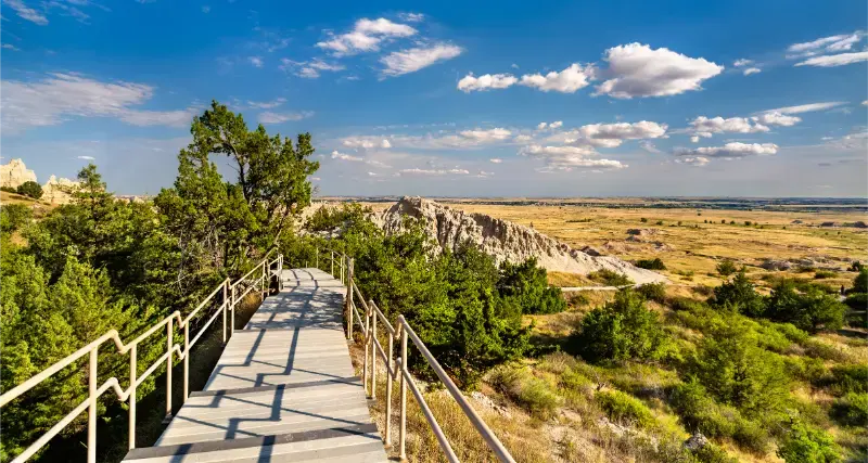
Choose a short trail that changes your perspective
The Window and Door areas provide quick access to the formations, while the Notch Trail is more committing and includes a log ladder plus exposed sections. Match the trail to heat, footwear, mobility and comfort with heights. The Badlands are not a place to prove fitness at midday in summer.
Stop at Ben Reifel Visitor Center
The visitor center adds geology, paleontology and practical context that makes the landscape more meaningful. It is also the place to check current road and trail conditions. If you are traveling with children, use the exhibits to break up scenic driving and give the day a clearer narrative than “another overlook.”
Use Sage Creek for wildlife and a different landscape
Sage Creek Rim Road is gravel and follows the north rim of the wilderness area. Bison, prairie dogs and other wildlife are often part of the experience, but sightings are never guaranteed. Drive slowly, stay in your vehicle around large animals when appropriate and give bison much more space than a phone camera makes seem necessary.
Protect sunrise or sunset if photography matters
The formations change character dramatically when the sun is low. Staying in Wall, Interior or closer to the park allows you to be in position without a pre-dawn drive from Rapid City. Choose either sunrise or sunset based on your route; trying to do both on a one-day transit visit often creates fatigue.
How much time do you really need?
A half-day can work if Badlands is a scenic stop between eastern South Dakota and Rapid City. Allow enough time for Highway 240, several overlooks and one short walk. A full day is much better for first-timers because it lets you include the visitor center, trails and Sage Creek without turning the park into a race.
One overnight nearby is the sweet spot for many road trips. Arrive in the afternoon, explore part of the Loop and sunset, then finish the park early the next morning before continuing west. This also creates a weather buffer: if afternoon storms or heat make hiking unpleasant, you still have another window.
Where to stay and how to choose the right base
Compare available accommodation for your dates, budget and preferred location before you finalize your route.
Wall has the broadest mix of road-trip services near the park and works well for travelers using I-90. Interior and park-area lodging/camping reduce the distance to sunrise and evening viewpoints but provide fewer dining choices. Rapid City is possible as a day-trip base, yet it adds roughly 75 miles each way to the park area and wastes the best light if you leave late.
Choose based on the next day. If you are continuing west, Wall is simple. If the park itself is the priority, stay as close as practical. If you arrive from the east late in the day, do not push through the entire Loop after sunset just to reach Rapid City; wildlife and unfamiliar curves are poor companions when tired.
Best time to go and what changes by season
Summer brings long daylight and full visitor services but also heat, thunderstorms and crowds. Hike early, carry more water than you think you need and use midday for the visitor center or scenic driving. Spring and fall can be excellent, with cooler temperatures and changing prairie conditions.
Winter is visually striking but should be treated as a weather trip. The park remains open, yet snow, ice and extreme conditions can close roads. NPS specifically advises checking current road conditions. Sage Creek Rim Road is particularly sensitive to precipitation because it is gravel.
How to fit this stop into a wider route
Badlands fits naturally before Rapid City on a westbound I-90 trip. From Wall, enter via Pinnacles and work east/southeast through the park, or reverse the direction if your next overnight makes that more logical. Build the route to avoid driving the Loop twice unless sunrise/sunset photography is intentional.
If you also plan to visit Minuteman Missile National Historic Site or Wall, group them by geography and operating hours. Do not squeeze a timed or ranger-led experience between two uncertain park drives. The best Badlands days remain flexible enough to pause for wildlife, weather or a trail that takes longer than expected.
Common planning mistakes
The most common mistake is equating short trails with easy conditions. Exposed ground, heat and wind can make a one-mile outing feel much harder than an urban walk. Another mistake is approaching wildlife for photos. Bison are fast, powerful and unpredictable; distance is not optional.
Do not trust GPS blindly in the more remote parts of the park. NPS notes that cell coverage and GPS reliability vary. Download the park map, know which entrance you are using and check Sage Creek conditions before committing to a gravel shortcut that looked fine on a routing app.
A useful plan B
If heat or storms cancel hiking, the Loop Road, overlooks and visitor center can still make a strong day. If heavy rain makes Sage Creek unsuitable, stay on paved roads and save the grassland section for another visit. A plan B here is not a lesser experience; it is often the safer one.
Who will enjoy this stop most?
Badlands is excellent for travelers who want major scenery without a long backcountry commitment. Families can combine boardwalks and viewpoints, photographers get rapidly changing light, and road-trippers can cross the park without losing an entire day to access roads.
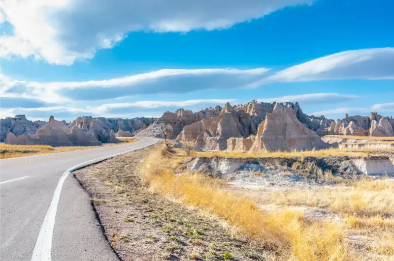
Travelers who dislike exposed heat or who have severe mobility limits should plan timing carefully rather than skip the park. Much of the scenery is visible from overlooks and paved areas. The key is to reduce walking during the hottest hours and allow more time for frequent stops.
A final decision framework before you add this stop
Before locking this stop into the itinerary, ask three practical questions: does it add an experience that is genuinely different from the previous day, does it sit in the direction you are already traveling, and will you arrive with enough energy to enjoy it rather than simply photograph it? Western South Dakota is compact on a state map but slow on scenic roads, and fatigue is one of the main reasons travelers remember a famous place less vividly than expected. Protect the stops that are central to your interests and let secondary stops remain optional.
If the answer is yes to all three questions, protect the time and reduce something else rather than compressing the entire day. If only one answer is yes, keep the stop flexible. This approach is especially useful when weather, wildfire smoke, thunderstorms, road construction or wildlife delays alter a Black Hills day. A good itinerary is not the one that survives every disruption unchanged; it is the one that can change without losing its best experiences.
For families, also consider the rhythm of the previous day. Two long scenic-driving days in a row can be harder than one substantial hike followed by a compact town day. For photographers, protect early and late light but avoid sacrificing sleep every morning. For international travelers, remember that mountain roads, parking systems and ranger-led programs may take longer to understand than familiar local attractions. A little unused time is a feature, not a planning failure.
Practical details to verify shortly before travel
Badlands National Park is open 24 hours, but visitor-center schedules, road conditions and seasonal services change. Check NPS alerts on the morning of your visit, especially in winter or after major storms. Do not treat the status of Sage Creek Rim Road as permanent.
Official source: National Park Service — Badlands National Park.
Continue planning South Dakota
Read the South Dakota travel guide for the full state route and the Rapid City guide if you are continuing west.
Final planning advice
The best Badlands visit is selective. Drive less, stop with purpose, walk when conditions are good and protect one low-light period if you can. The landscape is dramatic enough that you do not need to see every overlook to understand it.