

Death Valley is one of California’s most visually dramatic landscapes and one of its easiest places to underestimate. Distances are long, cell service is limited, roads can close after floods or fire operations, and summer heat can become life-threatening. The same features that make the park extraordinary—extreme elevation, aridity, remoteness and scale—also make preparation part of the visit.
This Death Valley National Park travel guide focuses on a first trip by car, with routes that keep safety ahead of a sightseeing checklist. The best time for most visitors is the cooler season, roughly late fall through early spring. Summer visitation is possible in an air-conditioned vehicle, but low-elevation hiking is strongly discouraged by the National Park Service.
In this guide
- Death Valley at a glance
- Best time
- 2026 road-status note
- Essential sights
- How many days
- Where to stay
- Driving routes
- Summer safety
- 1–2 day itinerary
- Hikes
- Night sky
- Mistakes
Death Valley at a glance
| Question | Practical answer |
|---|---|
| Best season | November–March for most visitors; shoulder months vary |
| How many days | 1 full day for highlights; 2 nights/2 days for a much better visit |
| Car needed | Yes for a typical first visit |
| Cell service | Limited or absent in large parts of the park |
| Summer hiking | Avoid low-elevation hiking in extreme heat |
| Road conditions | Check NPS/Caltrans immediately before travel |
Best time to visit Death Valley
Winter is the easiest season for most first-time visitors: mild daytime temperatures at low elevations, cooler nights and safer conditions for walking. February and March can bring wildflowers in favorable years, but blooms depend on rainfall and should be treated as a bonus rather than a guaranteed event.
October, November and April can work well but temperatures swing significantly. By late spring and summer, low-elevation heat can be extreme. NPS notes that summer temperatures can reach around 130°F (54°C), and overnight temperatures may remain very high. That changes what “sightseeing” safely means.
September 2026 road-status note
Death Valley’s road network is vulnerable to flood damage, construction and temporary closures. As of the NPS road-status update in August 2026, Bonnie Clare Road and access to Scotty’s Castle remained closed for flood-recovery work, while some other roads had damage or caution notices. Conditions can change after storms, so treat every specific road status in a travel article as temporary and verify the official park map just before departure.
Essential sights for a first visit
Badwater Basin
Badwater Basin sits 282 feet (86 m) below sea level and gives the park its clearest sense of vertical scale when you look toward surrounding mountains. Walk only as far onto the salt flats as temperature, time and footwear make sensible. In hot weather, the exposed walk becomes much more serious than the distance suggests.
Zabriskie Point
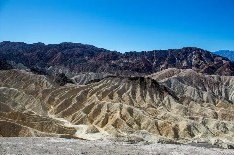
Zabriskie Point is one of the most accessible major viewpoints and particularly effective around sunrise or late light. The short walk from parking makes it useful on a one-day route, although crowding increases at classic photo times.
Dante’s View
Dante’s View rises thousands of feet above Badwater and gives an exceptional overview of the basin. The elevation also makes it cooler than the valley floor. It is a detour from the main Furnace Creek–Badwater corridor, so include drive time rather than treating it as a five-minute stop.
Artist’s Drive and Artist’s Palette
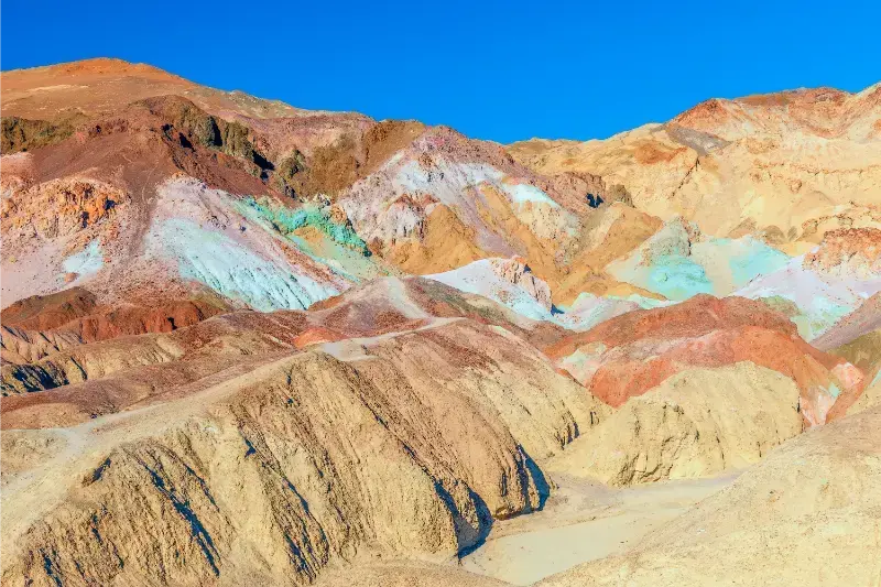
Artist’s Drive is a scenic one-way loop through colorful mineral-stained hills. Vehicle length restrictions and road rules apply; check current conditions. Late-day light can deepen colors, but never stop where the narrow road makes it unsafe.
Mesquite Flat Sand Dunes
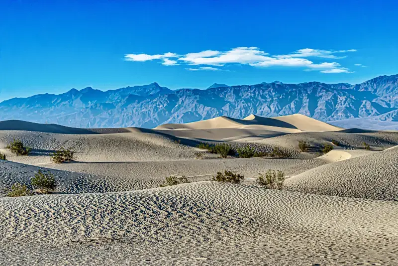
The dunes near Stovepipe Wells are easiest to access and especially beautiful near sunrise or sunset. There is no single marked route to “the top,” so set a turnaround point based on heat and energy. Sand temperatures can become intense during the day.
Ubehebe Crater
Ubehebe Crater lies in the northern part of the park and requires a significant drive from Furnace Creek. It is worthwhile on a two-day trip or when your route continues north, but less efficient in a one-day highlights itinerary.
How many days do you need?
- Half day: not recommended unless Death Valley is simply a transit stop.
- 1 full day: Zabriskie Point, Badwater, Artist’s Drive and a sunset/sunrise viewpoint.
- 2 days: add Mesquite Dunes, Dante’s View, Ubehebe or a moderate hike in cool conditions.
- 3 days: useful for photographers, hikers and remote-road exploration with appropriate vehicle/preparation.
Where to stay
Compare available accommodation for your dates, budget and preferred location before you finalize your route.
Furnace Creek is the most convenient first-time base because it sits near several core sights and visitor services. Stovepipe Wells is useful for dunes and western access. Panamint Springs works for west-side approaches and certain through-routes. Lodging is limited relative to the park’s size, so cooler-season weekends can fill.
Staying outside the park may save money but increases driving. Beatty, Pahrump and other gateway communities can work depending on your route, but a “near Death Valley” hotel can still be more than an hour from your first stop.
Compare accommodation: compare hotels and other stays on Booking.com.
Driving routes: Las Vegas, Los Angeles and Yosemite
From Las Vegas: Death Valley is a natural road-trip extension, but plan fuel and daylight. From Los Angeles: it is a long but manageable drive for an overnight trip. From Yosemite: routing depends completely on Tioga Road. When Tioga is open, the east-Sierra route is spectacular; when it is closed, the Sierra forces a much longer detour.
Never rely on a map app alone for dirt-road shortcuts. Navigation software may route drivers onto unpaved or storm-damaged roads that are inappropriate for standard rental cars.
Summer safety is not optional
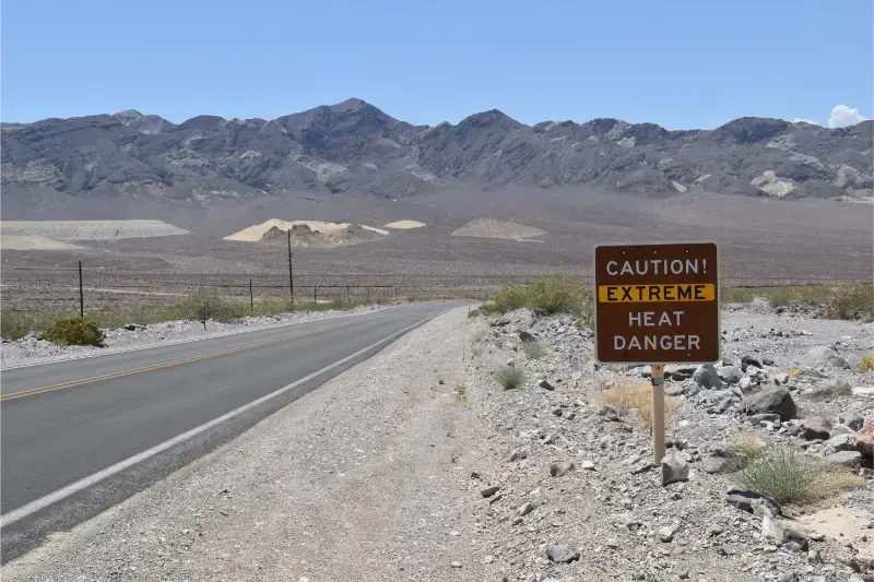
NPS explicitly advises against hiking at low elevations in extreme summer heat. If you visit in summer, stay close to a reliable air-conditioned vehicle, remain on paved roads, carry substantially more water than you expect to drink, and avoid turning a photo stop into an unplanned hike.
- Carry at least a gallon (about 4 liters) of water per person per day in summer, plus emergency reserve.
- Keep the fuel tank well above empty; distances between services are large.
- If your vehicle breaks down in extreme heat, stay with it unless there is an immediate danger.
- Share your route with someone outside the park.
- Treat flash-flood warnings seriously; desert roads can become impassable quickly.
A practical 1-day itinerary
- Sunrise or early morning at Zabriskie Point.
- Furnace Creek Visitor Center for conditions and water.
- Badwater Basin while temperatures are lower.
- Artist’s Drive / Artist’s Palette.
- Break during the hottest part of the day.
- Dante’s View or Mesquite Flat Sand Dunes for late light, depending on route.
With a second day, add Ubehebe Crater, Mosaic Canyon or another hike suited to season and fitness. Do not force remote northern sights into Day 1 if it means driving at night while tired.
Best hikes in cool weather
- Golden Canyon: accessible from the valley and expandable into longer loops.
- Mosaic Canyon: polished rock walls and a flexible out-and-back format.
- Mesquite Dunes: unmarked wandering rather than a conventional trail.
- Wildrose Peak / Telescope Peak: high-elevation options with very different weather and seasonal access; advanced planning required.
Check trail and road status before every hike. Heat, washouts and flash floods can change conditions faster than a printed itinerary.
Night sky and sunrise/sunset planning
Death Valley’s darkness is one of its greatest assets. If you stay overnight, give yourself one night-sky block away from bright facilities and another sunrise or sunset. Use safe pullouts and established areas, carry a headlamp and remember that wildlife and road edges are harder to judge after dark.
Common mistakes
- Visiting in summer with a winter-style hiking plan.
- Allowing the fuel tank to run low.
- Assuming cell service will rescue poor planning.
- Following an app onto an unsuitable dirt-road shortcut.
- Underestimating drive time between Badwater, dunes and northern sights.
- Failing to check road closures after storms or fires.
- Leaving water and emergency supplies at the hotel instead of in the vehicle.
Official planning resources
- Death Valley National Park – NPS — official visitor information.
- Death Valley alerts & road conditions — current closures.
- Death Valley safety — heat and emergency guidance.
Keep planning California
Death Valley fits naturally with Los Angeles, Yosemite when Tioga Road is open, and Joshua Tree on a Southern California desert route. Start at the California travel guide for the wider cluster.
Fuel, food, water and cell service: the practical reality
Death Valley is not the place to arrive with a quarter tank and the assumption that the next town is close. Fuel is available at a limited number of developed locations and can be expensive. Fill before entering when practical, then top up earlier than you would in a city road trip. Carry food that does not depend on one restaurant being open after a long drive.
Cell coverage is absent across much of the park. Download maps and your accommodation details before arrival, but remember that offline navigation does not know whether a dirt road has washed out. Official park road status takes precedence over an app-generated route.
Photography strategy: why sunrise and late light matter
Zabriskie Point and Mesquite Flat Sand Dunes are classic light-driven locations, while Badwater and Artist’s Palette change character as shadows move. A two-night stay lets you assign one sunrise and one sunset without driving across the park in darkness after an exhausting day. Bring a headlamp and never walk away from your vehicle at night without a clear return route.
Death Valley with children
Families can visit successfully in cool weather by emphasizing short walks, viewpoints and geology. Badwater, Zabriskie Point, Artist’s Drive and dunes all offer immediate visual rewards. The key is conservative pacing: children dehydrate quickly, distances are deceptive and there is little shade. Summer family visits should be vehicle-centered and very short outside the car.
What type of vehicle do you need?
A standard rental car is sufficient for the main paved first-time sights when roads are open. Remote unpaved routes can require high clearance, appropriate tires and desert-driving experience. Rental contracts may restrict unpaved use. Do not rent an SUV and assume that automatically makes every backcountry road safe or permitted.
Continue toward Nevada: Check current Death Valley roads before linking the park with Beatty, Tonopah and the Nevada road trip itinerary.