

Yosemite is not a single valley, a single viewpoint or a day trip from San Francisco. It is a large Sierra Nevada national park whose experience changes dramatically with season, elevation and road access. Yosemite Valley holds the most famous landmarks, but Glacier Point, Mariposa Grove, Wawona, Hetch Hetchy and the high country along Tioga Road can completely change what a visit feels like.
This Yosemite National Park travel guide is designed for first-time visitors who need to make the big decisions correctly: when to go, which entrance makes sense, whether roads will be open, where to sleep and how many days to allow. In 2026, Yosemite does not require a vehicle reservation for entry, but lodging, campgrounds, wilderness permits and Half Dome permits remain separate planning issues.
In this guide
- Yosemite at a glance
- 2026 reservations
- Best time
- Park areas
- How many days
- Where to stay
- Getting around
- Hikes
- 2–3 day itinerary
- Winter
- Safety
- California route planning
Yosemite at a glance
| Question | Practical answer |
|---|---|
| Vehicle reservation in 2026? | No entrance vehicle reservation is required in 2026 |
| How many days? | 2–3 full days for a first trip; more for hiking/high country |
| Best first-time base | Inside Yosemite Valley if available/budget allows; otherwise nearby gateway towns |
| Tioga Road | Seasonal; typically closed roughly November to late May/June |
| Half Dome | Permit required when cables are up |
| Best strategy | Arrive early, use shuttles where available, group each day by park area |
Reservations and permits in 2026: what you actually need
The National Park Service announced that Yosemite will not use a season-wide vehicle reservation system in 2026. That means you do not need a separate timed-entry reservation simply to drive into the park. You still need to pay the applicable entrance fee or show a valid pass.
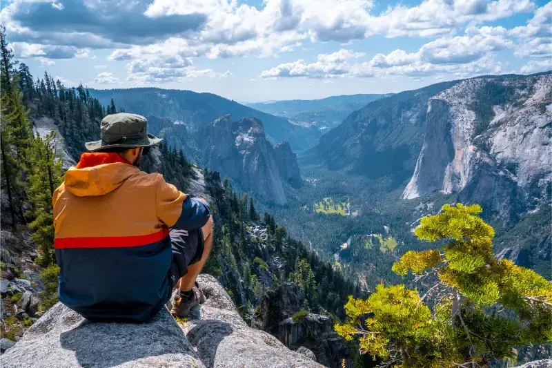
Do not interpret that as “nothing needs booking.” Lodging and many campgrounds can sell out well in advance. Overnight wilderness trips require wilderness permits. Hiking Half Dome when the cables are up requires a Half Dome permit. Some tours and activities may also have separate reservations.
No vehicle reservation in 2026 does not eliminate congestion. Weekends and holidays can still produce full parking areas and slow traffic, so early arrival and weekday visits remain valuable.
Best time to visit Yosemite
Spring: waterfalls and transitional conditions
Spring is famous for waterfalls, especially after snowy winters. Yosemite Valley is generally accessible, while higher roads and trails may still be snowbound. Tioga Road and Glacier Point Road often remain closed into late May or June, so do not plan a cross-Sierra route until official opening dates are confirmed.
Summer: maximum access, maximum demand
Summer provides the broadest access to high country and family activities, especially after Tioga Road opens. It is also the busiest period. In 2026, Tioga Road opened unusually early on May 15, but future years vary widely; always check the current NPS road page rather than using a previous year’s date.
Fall: excellent hiking, lower waterfalls
September and early October can be outstanding for hiking and high-country access with fewer peak-summer crowds. Waterfalls are usually much lower. Tioga Road can close temporarily with early storms and eventually closes for winter; overnight parking restrictions begin on the Tioga corridor in mid-October.
Winter: quiet valley, snowy logistics
Winter transforms Yosemite Valley and can be beautiful, but chains may be required and high-elevation roads close. A winter trip should focus on the valley, lower-elevation access and snow activities rather than a summer-style loop.
Understand Yosemite by area
Yosemite Valley
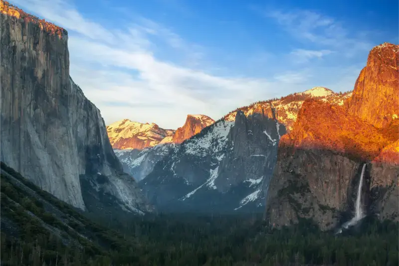
The Valley contains El Capitan, Half Dome views, Yosemite Falls, Bridalveil Fall and many of the park’s most recognizable landscapes. It is the logical first-time core, but also the busiest zone. Once parked, use shuttles and walking routes rather than moving the car between every stop.
Glacier Point Road
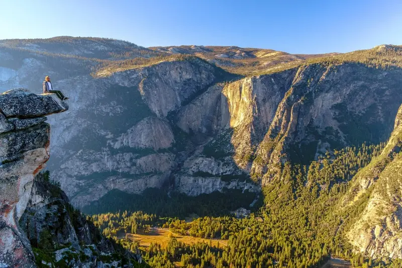
When open, Glacier Point Road gives access to sweeping high-elevation views and trailheads such as Sentinel Dome and Taft Point. It is seasonal and closes with winter snow. Pair it with Wawona or Mariposa Grove if your route enters from the south.
Tioga Road and Tuolumne Meadows
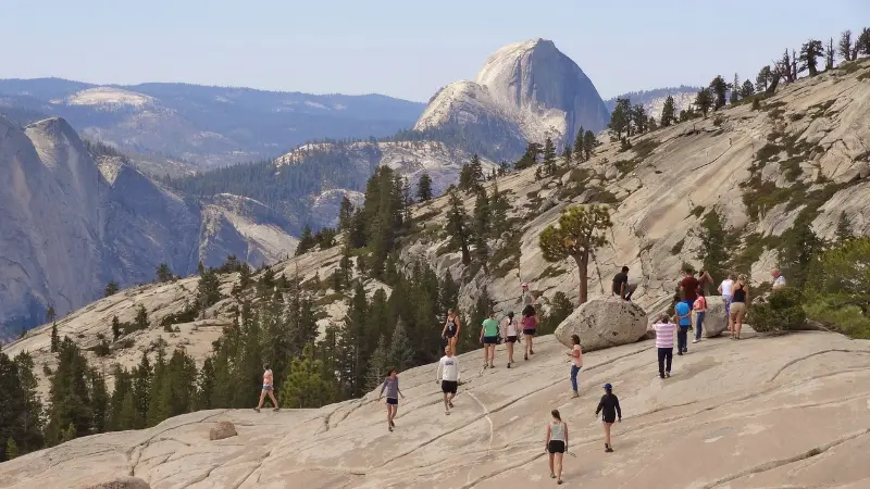
Tioga Road crosses the park’s high country and is one of California’s great mountain drives. Olmsted Point, Tenaya Lake and Tuolumne Meadows reveal a very different Yosemite from the Valley. Services can be limited, and the road closes in winter—often from November into late May or June.
Mariposa Grove and Wawona
Mariposa Grove is the park’s major giant-sequoia area and makes a logical stop for travelers entering via Highway 41. Shuttle and trail arrangements vary seasonally, so check current NPS access before arrival.
Hetch Hetchy
Hetch Hetchy sees fewer visitors and offers reservoir scenery and hiking, but access hours and road rules differ from the main park. It is best for repeat visitors or travelers with additional time rather than a first two-day visit.
How many days do you need?
- 1 day: Yosemite Valley only; worthwhile if that is all you have, but rushed.
- 2 days: Valley + one second area such as Glacier Point/Mariposa Grove.
- 3 days: Valley + south/Glacier Point + Tioga high country when open.
- 4–5 days: stronger hiking, slower mornings and more flexibility around traffic/weather.
Where to stay in and around Yosemite
Compare available accommodation for your dates, budget and preferred location before you finalize your route.
Staying inside the park reduces daily driving and makes sunrise/evening easier, but rooms and campsites can book early. Yosemite Valley is most convenient for first-time sightseeing. Wawona suits south-side plans; high-country lodging options are seasonal and limited.
Outside the park, El Portal is practical for Highway 140 access, Mariposa offers more town services farther west, Oakhurst serves Highway 41, and Groveland serves Highway 120. Lee Vining/Mammoth Lakes work only for east-side access when Tioga Road is open; in winter the closed pass makes the route dramatically longer.
Compare accommodation: compare hotels and other stays on Booking.com.
Getting around without losing half the day
Arrive early, park once in Yosemite Valley and use free shuttles/walking where practical. Traffic management changes by season and conditions, so use current park maps and alerts. If you are staying outside the park, factor gate queues and drive time into your morning rather than planning your first hike for the exact moment you reach the entrance.
The park is too large to treat every area as adjacent. Yosemite Valley to Tuolumne Meadows is a mountain drive, not a quick detour. Build one geographic area around each half day.
Best hikes for a first visit
- Lower Yosemite Fall: easy, classic Valley walk; flow varies strongly by season.
- Mirror Lake / Valley walks: flexible options for scenery without major elevation gain.
- Vernal Fall Footbridge / Mist Trail sections: steeper and wetter; conditions and closures matter.
- Sentinel Dome / Taft Point: excellent Glacier Point Road options when access is open.
- Tuolumne Meadows high-country walks: summer/fall options once Tioga Road opens.
- Mariposa Grove: giant sequoias with route lengths that can be adapted to time and fitness.
Half Dome is not a casual extension of a Valley walk. It is a long, strenuous undertaking and requires a permit when the cables are up. Treat it as a major hiking objective with weather, water and turnaround decisions planned in advance.
A realistic 3-day first-time itinerary
- Day 1: Yosemite Valley — Tunnel View, Valley landmarks, one moderate walk, evening light.
- Day 2: Glacier Point Road + Sentinel Dome/Taft Point or Mariposa Grove depending on season and interests.
- Day 3: Tioga Road + Tenaya Lake + Tuolumne Meadows when open; otherwise deepen the Valley/Wawona plan.
Visiting Yosemite in winter
Winter visitors should expect Tioga Road closure and limited high-country access. Chains can be required on all entrance roads during storms, including for vehicles with four-wheel drive depending on the restriction level. Highway 140 through El Portal is lower in elevation and often sees fewer chain controls, but conditions can still change rapidly.
Safety and practical planning
- Carry water and layers; mountain weather can change quickly.
- Store food properly and follow bear-safety regulations.
- Check air quality and wildfire information in fire season.
- Do not rely on cell service across the park.
- Verify road, trail and shuttle status on the official NPS site immediately before travel.
- In winter, understand tire-chain requirements before reaching the mountains.
How Yosemite fits into a California road trip
Yosemite pairs naturally with San Francisco when approached from the west. In summer, an open Tioga Road allows a spectacular east-side continuation toward Mono Lake, Mammoth Lakes and eventually Death Valley—but only when conditions permit. When Tioga closes, the Sierra becomes a major barrier and Yosemite-to-Death-Valley routing can expand to a full driving day around the mountains.
Use our two-week California road trip to see a first-time route, and combine park planning with the best time to visit California.
Official planning resources
- Yosemite National Park – NPS — official alerts and visitor information.
- Yosemite permits & reservations — current permit requirements.
- Tioga Road status — seasonal opening and plowing information.
Keep planning California
Continue with the California travel guide, San Francisco guide, Death Valley guide and best things to do in California.
Which entrance should you use?
Arch Rock / Highway 140 is a lower-elevation approach through El Portal and is often attractive in winter because it has fewer high passes. South Entrance / Highway 41 works well from Fresno, Oakhurst and Southern California and places Mariposa Grove near the route. Big Oak Flat / Highway 120 is logical from San Francisco and the northern Central Valley. Tioga Pass is the spectacular east entrance from US 395—but only when Tioga Road is open.
Do not choose an entrance by straight-line distance. Winter closures, chain controls and your overnight base can change the fastest route. If your accommodation is inside the park, follow its recommended entrance rather than allowing a navigation app to improvise a mountain shortcut.
Yosemite with kids
Families do best with one major walk per half day and plenty of time along the Valley floor. Lower Yosemite Fall, meadows, shuttle rides and short viewpoint stops can be more rewarding for young children than pushing everyone toward a famous strenuous trail. Mariposa Grove and the high country add variety for older children when seasonal access is open.
Food availability and queues can be frustrating with hungry children, so carry snacks and water even when staying in the Valley. Never leave food unattended: Yosemite food-storage rules are about protecting bears as much as protecting your car.
Photography and sunrise without creating a logistics problem
Tunnel View, Valley View and several meadow locations are popular around sunrise and sunset, but parking is limited and wildlife may be active. Use legal spaces only and keep roads clear. The strongest photographs often come from revisiting one location in changing light rather than racing between five viewpoints in an hour.
What to book first
- Inside-park lodging or campground if that is your priority.
- Any wilderness or Half Dome permit required for your hiking plan.
- Gateway accommodation with flexible cancellation if inside-park options are unavailable.
- Rental car and broader California route only after you understand whether Tioga Road is likely to be open for your season.
If giant sequoias are part of your Sierra itinerary, compare Yosemite with our Sequoia & Kings Canyon National Parks guide.
If you are deciding between Sierra parks, read Sequoia vs Yosemite before finalizing the route.