

California Highway 1 is one of the most famous road-trip roads in the world, but the phrase “Pacific Coast Highway” can be confusing. In Southern California, PCH often refers to specific signed sections of State Route 1; travelers use the name more broadly for the coast-hugging road trip from San Francisco through the Central Coast and on toward Los Angeles, Orange County and San Diego. The experience matters more than the label.
A strong Pacific Coast Highway road trip is not a race between two cities. It is a sequence of distinct coastal regions—Monterey Bay, Big Sur, San Luis Obispo County, Santa Barbara, Malibu, Los Angeles and Orange County—linked by a road whose condition can change with fire, storms, slides and construction. Build flexibility into the itinerary from the beginning.
- 1Day 1: San Francisco to Monterey / Carmel
- 2Day 2: Monterey / Carmel to Big Sur
- 3Day 3: Big Sur to Cambria / San Luis Obispo
- 4Day 4: San Luis Obispo to Santa Barbara
- 5Day 5: Santa Barbara to Los Angeles
- 6Days 6–7: Los Angeles
- 7Days 8–10: Orange County to San Diego
In this guide
- 2026 road-status note
- North or south?
- How many days
- 7–10 day route
- Essential stops
- Where to stay
- Driving tips
- Budget
- Families
- Mistakes
- What if Highway 1 closes?
September 2026 Highway 1 road-status note
Highway 1 fully reopened through the long Regent’s Slide repair zone in January 2026, but that did not make the route immune to new disruptions. In late August and early September 2026, wildfire response again closed parts of Big Sur. Caltrans road information reported on September 11 that a section near Kirk Creek in Monterey County remained closed because of wildfire activity, with additional one-way traffic control near Rocky Creek Bridge.
Never build a non-refundable California itinerary on the assumption that every mile of Highway 1 will remain open. Check Caltrans QuickMap and current SR 1 conditions shortly before driving; keep US 101 as the practical bypass.
Should you drive northbound or southbound?
Southbound is often preferred because the ocean and many pullouts are on the right side of the road, which can make scenic stops simpler. It also creates a natural first-time route from San Francisco to Monterey, Big Sur, the Central Coast and Los Angeles. Northbound is still spectacular and may fit flights or a larger itinerary better.
Direction matters less than pace. A hurried southbound drive is worse than a well-planned northbound trip. Choose based on flight prices, car-rental logistics and the rest of California—not only photography advice.
How many days do you need?
| Time | What it realistically allows |
|---|---|
| 3 days | One Central Coast section; not the full San Francisco–San Diego experience |
| 5 days | San Francisco to Los Angeles with selective stops and little downtime |
| 7 days | Strong first-time San Francisco–Los Angeles coastal itinerary |
| 8–10 days | Add Orange County/San Diego or slower 2-night bases |
| 12+ days | Coast-focused vacation with beaches, hikes and wine-country detours |
A 7–10 day Pacific Coast Highway itinerary
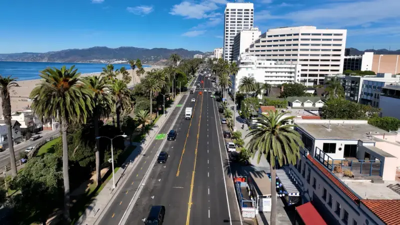
Day 1: San Francisco to Monterey / Carmel
Leave San Francisco after your city stay and follow the coast or faster inland segments depending on time. Santa Cruz can be a worthwhile stop, but Monterey and Carmel deserve the overnight. Walk Cannery Row only if it interests you; Point Lobos or Carmel’s coast may be more compelling for scenery.
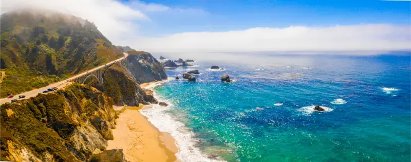
Day 2: Monterey / Carmel to Big Sur
This should be a short-distance, long-experience day. Bixby Bridge, coastal viewpoints, redwood groves and state parks turn a modest mileage total into a full day. Stay in Big Sur if budget and availability allow, or use Carmel/Monterey or Cambria/San Simeon as practical bases depending on road status.
Day 3: Big Sur to Cambria / San Luis Obispo
Continue south only if Highway 1 is open through the route. Stops may include McWay Falls viewpoints when accessible, Ragged Point, elephant-seal viewing near San Simeon and Hearst Castle. Cambria gives a small-town overnight; San Luis Obispo provides more restaurants and services.
Day 4: San Luis Obispo to Santa Barbara
Pismo Beach, the Santa Ynez Valley and wine-country detours can fill the day. Santa Barbara is worth an overnight rather than a fuel stop: Spanish-influenced architecture, waterfront, restaurants and a compact center give the road trip a different rhythm from Big Sur.
Day 5: Santa Barbara to Los Angeles
Ventura and Malibu create a scenic transition into metropolitan Southern California. Traffic becomes a major planning variable. Do not schedule a rigid Hollywood reservation 30 minutes after your projected arrival; the same distance can take dramatically different times.
Days 6–7: Los Angeles
Park the road-trip mindset and explore by neighborhood. Use our Los Angeles travel guide and Los Angeles itinerary. If LA is already familiar, continue to Orange County.
Days 8–10: Orange County to San Diego
Laguna Beach, Crystal Cove, Newport Beach and other coastal stops create a softer final stretch before San Diego. Spend at least two nights in San Diego if you want more than a beach photo and airport departure.
The essential stops—and which ones can be skipped
- Monterey/Carmel: worth an overnight for Point Lobos, coast and walkable town atmosphere.
- Big Sur: essential if the road is open; allow a full day rather than racing through.
- San Simeon/Cambria: useful for Hearst Castle, elephant seals and breaking the route.
- San Luis Obispo/Paso Robles: strong food/wine detour if you have extra time.
- Santa Barbara: one of the route’s best all-round overnight stops.
- Malibu: scenic but traffic-sensitive; choose a few stops rather than beach-hopping endlessly.
- Orange County: worthwhile for beaches and towns if continuing to San Diego.
Where to stay along the route
Compare available accommodation for your dates, budget and preferred location before you finalize your route.
Avoid changing hotels every night if you have eight or more days. Two-night bases in Monterey/Carmel, Santa Barbara, Los Angeles or San Diego reduce packing fatigue. Big Sur lodging is limited and expensive; book early or base nearby. Cambria is often a practical compromise between Big Sur scenery and Central Coast pricing.
Compare accommodation: compare hotels and other stays on Booking.com.
Driving tips that matter on Highway 1
- Use legal pullouts; never stop in the travel lane for a photo.
- Do not make unsafe U-turns near Bixby Bridge or other crowded viewpoints.
- Fuel before remote stretches rather than waiting for the warning light.
- Download offline maps, but trust official closures over navigation-app shortcuts.
- Expect cyclists, slow vehicles, wildlife and sudden fog.
- If cars stack behind you, use a safe turnout rather than accelerating beyond your comfort.
Visit California and local authorities specifically urge responsible behavior around Bixby Bridge and Big Sur. Scenic roads remain public roads with residents, emergency vehicles and workers—not outdoor photo studios.
Budget: where the money goes
The road itself is mostly free, but the trip can become expensive through coastal hotels, one-way rental fees, parking, fuel and premium restaurants. Save strategically by mixing destination hotels with simpler roadside stays, booking Big Sur/Monterey early and avoiding unnecessary rental-car days inside San Francisco.
Do not sacrifice route logic for a cheap hotel 60 miles inland if it creates two hours of extra driving the next morning. On a road trip, location is part of the travel cost.
Pacific Coast Highway with kids
Families should shorten driving blocks and add predictable stops: Monterey Bay Aquarium, beaches, parks, elephant seals, Santa Barbara waterfront and San Diego attractions. Big Sur viewpoints require close supervision because cliffs and roadside traffic are real hazards.
Common mistakes
- Calling every coastal road “PCH” and assuming one continuous signed highway experience.
- Trying to drive San Francisco to Los Angeles via Big Sur in one sightseeing day.
- Booking non-refundable Big Sur stays without a closure fallback.
- Arriving at Bixby Bridge and stopping where parking is prohibited or unsafe.
- Ignoring LA traffic when estimating arrival times.
- Changing hotels every night on a 10-day trip.
- Following navigation apps around closures on unsuitable local roads.
What to do if Highway 1 closes
Use US 101 as the primary north–south bypass through the Central Coast and treat open Highway 1 segments as out-and-back scenic excursions where permitted. A closure does not ruin a California trip: Monterey/Carmel can still be reached from the north, Cambria/San Luis Obispo from the south, and US 101 connects the regions inland.
Do not attempt to “find a local way around” a closure. Fire, landslide and construction closures often have no safe public shortcut.
Official planning resources
- Caltrans QuickMap — real-time California road conditions.
- Caltrans Highway Conditions — current SR 1 restrictions.
- Visit California – Highway 1 road trip — official state tourism route ideas.
Keep planning California
Use our Big Sur travel guide for the most sensitive stretch, then connect the route to San Francisco, Los Angeles and San Diego. For the wider state, return to the California travel guide.
Rental-car strategy: one-way fees, city parking and timing
A one-way rental can be worth the surcharge because it prevents backtracking hundreds of miles. Compare the total price, not just the daily rate. If the trip starts in San Francisco, keep the first city days car-free and collect the vehicle on departure. If it ends in San Diego, return the car before a final downtown stay if you no longer need it.
Check rental terms for additional drivers, toll programs and roadside assistance. Highway 1 is paved, but closure detours and scenic side roads can tempt drivers onto routes that rental agreements do not cover.
How to build reservations around a road that can close
Book the scarce places first—Big Sur or Monterey/Carmel on peak dates—then favor flexible rates farther south. If a closure appears, you need the ability to shift a night from Big Sur to Monterey, Cambria, Paso Robles or Santa Barbara. A rigid chain of non-refundable hotels turns a normal road closure into a financial problem.
Best seasons for the coastal drive
Late spring and early fall are often excellent compromises for daylight and demand, but every season has trade-offs. Summer can bring coastal fog and high hotel rates. Winter can be dramatic and quiet but storm-driven slides are more likely. Fall may be clearer but wildfire conditions can disrupt access. There is no “closure-proof” month.
What to pack in the car
- Refillable water and simple snacks for remote stretches.
- A warm layer: Big Sur and San Francisco can be cool even when inland California is hot.
- Offline maps plus current Caltrans links saved before departure.
- Phone charger / power bank.
- Comfortable walking shoes for state parks and towns.
- A small buffer in the daily schedule—arguably the most important item.
Plan the Central Coast in more depth with our Santa Barbara and Monterey & Carmel guides.
Driving the entire coast? See our Los Angeles to San Francisco Highway 1 road trip for current closure planning.