

California’s desert landscapes are close enough to combine and different enough to justify a dedicated trip. Palm Springs gives you mid-century architecture, resorts and an easy urban base; Joshua Tree adds boulder fields and two desert ecosystems; Death Valley expands the scale dramatically with salt flats, dunes, canyons and some of the hottest terrain on Earth.
The key is season. A desert road trip that is excellent in February can be dangerous in July. For most travelers, November through March is the ideal window, with October and April also workable depending on heat. This itinerary is designed around 6–8 days and prioritizes safety over collecting every viewpoint.
Best desert road trip route
| Days | Base | Main experiences |
|---|---|---|
| 1–2 | Palm Springs | Architecture, downtown, tramway when operating, pool/spa time |
| 3–4 | Joshua Tree / Twentynine Palms | Hidden Valley, Keys View, boulders, desert sunset/stars |
| 5–7 | Death Valley | Zabriskie Point, Badwater Basin, Artists Drive, dunes, canyon walks |
| 8 | Las Vegas or Los Angeles departure | Choose based on flights and one-way rental economics |
When to go: this is the most important decision
Winter is the safest and most comfortable season for a broad desert trip. Daytime temperatures support hiking while nights can be cold, especially in Joshua Tree’s higher areas. Spring brings wildflower potential in favorable years but also increasing heat. Fall improves as temperatures drop.
Summer requires a completely different plan. Joshua Tree regularly exceeds 100°F / 38°C and Death Valley can be far hotter. Long hikes should be removed, vehicle reliability becomes more critical and many travelers are better off postponing the desert portion entirely.
Days 1–2: Palm Springs
Palm Springs is a useful soft landing before the national parks. Spend the first day downtown, exploring mid-century architecture and settling into the desert climate. On the second day, combine a neighborhood/design focus with the Palm Springs Aerial Tramway when it is operating.
As of September 2026, the Aerial Tramway is closed for annual preventative maintenance from September 8 through October 4, with tentative reopening on October 5. This is a perfect example of why attraction operating calendars should be checked close to travel.
See our full Palm Springs travel guide for neighborhoods, resort strategy and seasonal advice.
Days 3–4: Joshua Tree National Park
Drive from Palm Springs into Joshua Tree with enough daylight for an orientation loop. Hidden Valley, Barker Dam area, Skull Rock and Keys View can create a strong first day depending on interests and conditions. A second day lets you hike early, visit quieter areas and stay through sunset rather than racing onward.
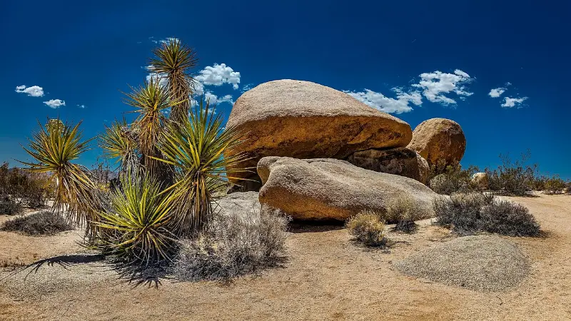
Joshua Tree has extreme summer heat and seasonal restrictions. In 2026, NPS implemented park-wide fire restrictions from June 15 through October 1, and certain summer campgrounds, trails and backcountry zones have seasonal closures. Always check the current-conditions page before entering.
Use our Joshua Tree travel guide for a more detailed first-visit plan.
Days 5–7: Death Valley National Park
Death Valley deserves at least two nights if it is a main trip goal. Zabriskie Point, Badwater Basin, Artists Drive, Mesquite Flat Sand Dunes and one or two canyon walks already fill a substantial itinerary. Distances are large and the park’s apparent emptiness can make driving times deceptive.
Current road conditions matter. As of early September 2026, NPS lists Scotty’s Castle/Bonnie Clare Road closed for flood-recovery work and reports caution on several other roads. Titus Canyon Road is temporarily open after repairs but is scheduled for closure for additional work from October 1, 2026 through September 30, 2027. Treat remote-road plans as provisional until verified.
Our Death Valley travel guide covers road safety and park logistics in more depth.
Which direction should you drive?
If your larger trip begins in Los Angeles, Palm Springs → Joshua Tree → Death Valley → Las Vegas is an efficient one-way pattern. In reverse, Las Vegas → Death Valley → Joshua Tree → Palm Springs/Los Angeles works equally well. Compare airfare and one-way rental charges before deciding.
Fuel, water and EV planning
Top up the vehicle before long desert legs. Services are sparse compared with coastal California, cell reception is unreliable and detours can add significant mileage. Carry drinking water in the cabin, not just in the trunk, and keep a reserve beyond your planned daily use.
EV travel is possible, but it requires more deliberate charging planning and larger buffers than a city itinerary. Confirm charger status before entering remote areas and do not arrive at a national park boundary with a marginal battery expecting a convenient fast charger.
Desert driving safety
- Check tires, coolant and fuel before remote legs.
- Stay on designated roads and respect road-closure signs even if a navigation app suggests otherwise.
- Do not hike far from the vehicle in extreme heat.
- Tell someone your route before using remote unpaved roads.
- Download offline maps; cell service is not reliable enough for emergency dependence.
- Flash floods can affect desert roads even when rain is distant. Never enter moving water across a roadway.
Where to stay
Compare available accommodation for your dates, budget and preferred location before you finalize your route.
| Stop | Best base strategy |
|---|---|
| Palm Springs | Stay downtown or in a resort area depending nightlife vs pool focus. |
| Joshua Tree | Joshua Tree village for restaurants/atmosphere; Twentynine Palms for north entrance convenience; park campgrounds for stars. |
| Death Valley | Inside/near Furnace Creek for first-timer convenience; Stovepipe Wells for dunes/north-central access. |
Compare accommodation: compare hotels and other stays on Booking.com.
A family version
Families should shorten hikes and add more viewpoint-based stops. Joshua Tree’s rock formations are instantly engaging for children, but climbing supervision is essential. Death Valley is fascinating but can involve long drives between sights; build picnic and visitor-center breaks into the day.
In hot weather, do not use children as a reason to ‘just do a short hike.’ Smaller bodies can overheat quickly, and desert shade is limited. Move outdoor activity to early morning and keep afternoons vehicle-based or at the hotel.
Add-ons: Route 66, Mojave and Las Vegas
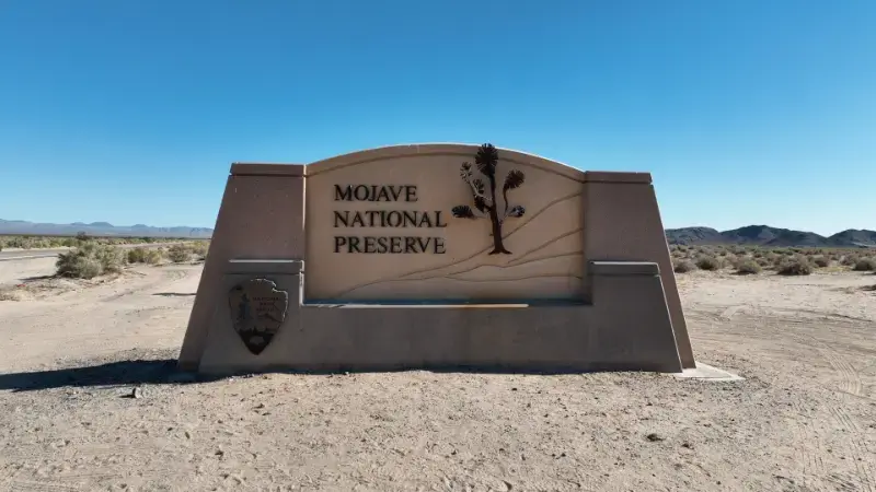
With extra time, Route 66 segments near Barstow/Amboy can add classic road-trip character, while Mojave National Preserve opens a quieter desert experience. Las Vegas is the easiest flight gateway on the Death Valley side. Do not add every desert name simply because it lies somewhere on the map—each detour consumes fuel, daylight and energy.
Official resources
- Joshua Tree current conditions.
- Death Valley road and current conditions.
- Palm Springs Aerial Tramway — current operating calendar.
For statewide timing, pair this itinerary with our best time to visit California guide. A desert trip is one of the clearest examples of why California cannot be planned with one statewide weather assumption.
Photography, stars and desert light
Desert scenery is strongest when the sun is low. Plan key viewpoints around sunrise and late afternoon, and use midday for transfers, visitor centers or hotel time. Joshua Tree is also known for dark skies, while Death Valley can deliver exceptional night-sky conditions away from developed areas.
Night photography adds a different safety problem: unlit roads, wildlife, cold winter temperatures and disorientation around rocky terrain. Scout locations before dark and never stand in a roadway for a photograph.
A practical planning checklist
- Check official road, weather and operating conditions again 48–72 hours before travel.
- Keep at least one flexible block in the itinerary for traffic, weather or an attraction closure.
- Download offline maps and reservation confirmations before entering low-signal areas.
- Avoid stacking a long transfer, a timed attraction and a late hotel check-in on the same day.
- Recheck parking rules and opening hours on the morning of high-demand activities.
California trips work best when the itinerary distinguishes fixed reservations from flexible sightseeing. Reserve the experiences that truly need a time slot, then leave enough unscheduled space to adapt. That approach is especially valuable on coastal, mountain and desert routes where conditions can change faster than the travel plan.
How many nights in each desert stop?
Palm Springs can work with two nights, Joshua Tree with one or two, and Death Valley with two or three. If you have only five nights total, skip one destination rather than reducing every stop to a half-day. Death Valley is the first place where rushed planning becomes inefficient because key sights are separated by long drives.
For an eight-night version, add a third Palm Springs night for rest or architecture and a third Death Valley night for a canyon hike or more remote viewpoints. Extra time is most useful when it reduces driving rather than when it adds another distant detour.
What to pack for desert temperature swings
Winter mornings can be genuinely cold while afternoons feel warm in the sun. Pack layers, a sun hat, sunglasses, lip protection and more water capacity than you would carry on a coastal city trip. Closed shoes are more useful than sandals around rocky trails and cactus.
A paper map is still valuable. Offline digital maps are essential, but batteries fail and phones overheat. Remote-desert travel is one of the rare California itineraries where simple redundancy makes a meaningful safety difference.
How to make this stop fit a larger California itinerary
The most successful California itineraries are built around geographic clusters rather than a list of famous names. Keep nearby experiences together, allow a realistic transfer day when moving between regions and avoid reserving every hour. A flexible afternoon can absorb traffic, weather, road closures or simply the desire to stay longer somewhere that exceeds expectations.
Before departure, review the California state hub and the linked regional guides to make sure the stop sits naturally between the destinations before and after it. If adding this article’s destination creates a long out-and-back detour, it may belong on a future trip rather than the current one.