

California has nine national parks, more than any other U.S. state, but trying to ‘do all nine’ in one short vacation is a classic road-trip mistake. The parks stretch from the Mexican-border deserts to redwood country near Oregon, with islands offshore and high Sierra roads that close seasonally. The right trip is not a checklist; it is a route built around season, driving tolerance and the landscapes you care about most.
This guide gives you two useful plans: a realistic 18–21 day grand route for travelers who want to see most of the parks, and shorter regional loops for people with one or two weeks. It also explains the seasonal traps—Death Valley heat, Sierra snow, Lassen road closures and ferry logistics for Channel Islands—that matter more than mileage.
- 1Joshua Tree
- 2Death Valley
- 3Sequoia & Kings Canyon
- 4Yosemite
- 5Pinnacles
- 6Channel Islands gateway
- 7Channel Islands / coast
- 8Redwood
- 9Lassen Volcanic
- 10Buffer / Sacramento or San Francisco
California’s nine national parks
| Park | Signature experience | Planning issue |
|---|---|---|
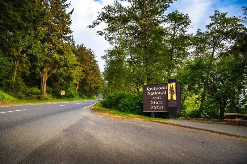
| Redwood | Tall coast redwoods, wild beaches | Far north; long transfer distances |
| Lassen Volcanic | Hydrothermal areas, volcanic peaks | Park highway strongly seasonal |
| Yosemite | Granite cliffs, waterfalls, Sierra hiking | Peak-season crowds; mountain roads seasonal |
| Kings Canyon | Deep Sierra canyon, sequoias | Scenic byway seasonal |
| Sequoia | Giant sequoias, high Sierra | Winding access roads |
| Pinnacles | Rock formations, condors, caves | Very hot summers; east/west entrances not connected by road |
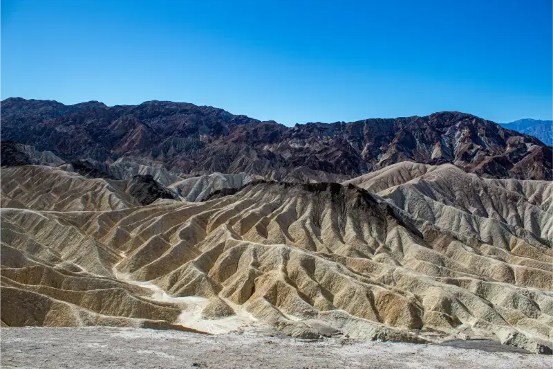
| Death Valley | Extreme desert, Badwater, dunes | Dangerous summer heat |
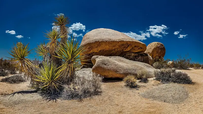
| Joshua Tree | Desert landscapes, boulders, Joshua trees | Heat; large distances inside park |
| Channel Islands | Marine wildlife, hiking, sea caves | Boat/flight logistics; weather-dependent |
The best season for a multi-park road trip
There is no perfect month for all nine parks. Late spring can be beautiful, but some high Sierra and Lassen roads may still be closed by snow. Mid-summer opens high-country routes but creates dangerous heat in Death Valley and Joshua Tree. Early fall often gives strong Sierra access and cooler desert mornings, yet wildfire and smoke can affect mountain and coastal regions.
For a broad road trip, late September into October can be a good compromise if you accept shorter daylight and monitor mountain weather. For a Sierra-focused loop, June through September is more predictable. For a desert-heavy trip, November through March is far more comfortable.
18–21 day California national parks route
| Days | Base / park | Core plan |
|---|---|---|
| 1–2 | Joshua Tree | Keys View, Hidden Valley, boulder landscapes, sunset; sleep nearby. |
| 3–4 | Death Valley | Badwater Basin, Artists Drive, Zabriskie Point, dunes; avoid summer version of this route. |
| 5–7 | Sequoia & Kings Canyon | Giant Forest, Grant Grove, Kings Canyon road if open. |
| 8–10 | Yosemite | Valley, Glacier Point/Mariposa Grove, one major hike or high-country day. |
| 11 | Pinnacles | Hike early; overnight Monterey/Salinas area or nearby. |
| 12 | Channel Islands gateway | Ventura/Santa Barbara positioning; island trip requires separate boat day and weather flexibility. |
| 13–14 | Channel Islands / coast | One island day plus buffer or Santa Barbara coast. |
| 15–16 | Redwood | Prairie Creek/Redwood Creek coast-redwood experience. |
| 17–18 | Lassen Volcanic | Park Highway, hydrothermal areas, Manzanita Lake when open. |
| 19–21 | Buffer / Sacramento or San Francisco | Absorb weather changes, long transfers and departure logistics. |
This sequence is intentionally not optimized to the last mile because Channel Islands creates a coastal detour and northern parks require long drives. If your goal is efficiency rather than completing all nine, use the regional loops below.
Best 10-day route: Southern California + Sierra
For most first-time visitors, the strongest national-park loop is Joshua Tree → Death Valley → Sequoia/Kings Canyon → Yosemite. It combines two deserts with giant sequoias and granite Sierra scenery, and every stop feels distinct. In hot months, remove Death Valley and add more Sierra time.
- Days 1–2: Joshua Tree
- Days 3–4: Death Valley
- Days 5–6: Sequoia & Kings Canyon
- Days 7–10: Yosemite
Best Northern California parks loop
A different trip can combine San Francisco → Pinnacles → Redwood → Lassen, optionally finishing in Sacramento or Lake Tahoe. This loop avoids the Southern California deserts and works best when Lassen’s park highway is open to through traffic. NPS notes that the 30-mile Lassen highway typically closes to through traffic during the snowy season and is generally a summer-to-fall drive.
Channel Islands: the park that does not fit a normal road trip
Channel Islands National Park is accessed by boat or small aircraft, not by driving onto the islands. That means weather, sailing schedules and advance bookings matter. Treat Ventura as a gateway and keep buffer time if the island is a priority. Do not force Channel Islands into an already crowded road trip simply because it sits geographically near the Southern California coast.
Pinnacles: small park, important logistics
Pinnacles is ideal as a hiking stop between Central Coast destinations and Northern California, but the east and west entrances are not connected by a road through the park. Choose the entrance based on your hike and lodging. NPS warns of heavy visitation on weekends and spring days; early arrival is important when parking is limited.
Sierra road strategy
Yosemite, Sequoia and Kings Canyon look close on a state map but the Sierra complicates direct routes. Tioga Road crosses Yosemite seasonally, while Sequoia access is on the western side. Never plan a transfer across a mountain pass without checking whether it is open.
In 2026 Yosemite does not require a vehicle reservation for entry, but that does not remove the need to book lodging, camping and certain permits. Sequoia/Kings Canyon current conditions also change with fire, construction and winter damage.
Desert safety: Death Valley and Joshua Tree
Do not use the same itinerary in July that you would use in February. Death Valley summer heat can be life-threatening and changes which activities are sensible. Joshua Tree also exceeds 100°F / 38°C on many summer days, with seasonal trail and campground restrictions. In desert months, carry far more water than you think you need and reduce hiking ambition.
Where to fly in and out
A one-way rental can save enormous backtracking on the full route. Los Angeles, San Diego, San Francisco, Sacramento and Las Vegas can all function as useful gateways depending on the parks. Before committing to an open-jaw itinerary, compare rental-car one-way fees and flight prices rather than assuming the geographically neat option is cheapest.
How much driving is too much?
If you have 14 days, do not target all nine parks. Four to five major parks is usually enough. Long national-park days already include driving to trailheads, viewpoints and lodging; adding four-hour transfers every second day turns scenery into windshield time.
The best road trip has rest built in. A two-night minimum is useful for Yosemite, Sequoia/Kings Canyon and Redwood. Three nights in Yosemite is even better if hiking is important.
Official resources
- National Park Service: California parks — official park list and links.
- Lassen road access — seasonal road conditions and winter closures.
- Pinnacles trip planning — entrances, weather and parking advice.
- Visit California road trips — statewide route inspiration.
If you want a broader state itinerary that mixes parks with cities and coast, start with our two-week California road trip. For park-by-park detail, use the individual guides linked throughout this route.
Camping and lodging reservations
National-park lodging and campgrounds can sell out long before the road trip, especially Yosemite and popular Sierra areas. Build the route around the hardest reservations first, then fill in easier city or roadside nights. If you cannot secure in-park lodging, calculate the real morning drive from gateway towns before booking.
Camping rules and reservation windows differ by park and season. Recreation.gov is used for many federal campgrounds and permits, but not every accommodation product follows the same calendar. Confirm each park individually rather than assuming one system covers the whole trip.
A practical planning checklist
- Check official road, weather and operating conditions again 48–72 hours before travel.
- Keep at least one flexible block in the itinerary for traffic, weather or an attraction closure.
- Download offline maps and reservation confirmations before entering low-signal areas.
- Avoid stacking a long transfer, a timed attraction and a late hotel check-in on the same day.
- Recheck parking rules and opening hours on the morning of high-demand activities.
California trips work best when the itinerary distinguishes fixed reservations from flexible sightseeing. Reserve the experiences that truly need a time slot, then leave enough unscheduled space to adapt. That approach is especially valuable on coastal, mountain and desert routes where conditions can change faster than the travel plan.
How to split the nine parks into two excellent trips
A smarter long-term strategy is to divide California’s parks into a southern/Sierra trip and a northern/coastal trip. The southern trip can combine Joshua Tree, Death Valley, Sequoia, Kings Canyon and Yosemite. A second trip can focus on Pinnacles, Redwood, Lassen and Channel Islands with the coast and San Francisco between them.
This split is far less exhausting than a forced statewide loop and lets you travel in the best season for each group. Winter is ideal for the deserts but poor for high Sierra crossings; summer opens the mountains but can make Death Valley inappropriate for hiking.
National park pass: is it worth it?
If your itinerary includes several federal recreation sites that charge entrance fees, compare individual fees with the current America the Beautiful annual pass. The pass can provide value quickly, but it does not cover every cost: camping, tours, ferries, special permits and some concession services are separate.
Channel Islands boat transport, for example, is not replaced by a national-park pass. Likewise, a pass does not create a campsite or wilderness permit. Think of it as an entrance-fee tool, not an all-inclusive park product.
What to reserve first
Start with Yosemite lodging or camping, then secure any required Channel Islands transportation and high-demand Sierra accommodation. Add the easier roadside nights only after the constrained pieces are in place. This reverses the common mistake of booking a neat sequence of hotels and then discovering the core park nights are unavailable.
Keep at least one night flexible on a three-week route. Wildfire smoke, storms, road construction or simple fatigue can make that buffer the most valuable reservation of the trip.
How to make this stop fit a larger California itinerary
The most successful California itineraries are built around geographic clusters rather than a list of famous names. Keep nearby experiences together, allow a realistic transfer day when moving between regions and avoid reserving every hour. A flexible afternoon can absorb traffic, weather, road closures or simply the desire to stay longer somewhere that exceeds expectations.
Before departure, review the California state hub and the linked regional guides to make sure the stop sits naturally between the destinations before and after it. If adding this article’s destination creates a long out-and-back detour, it may belong on a future trip rather than the current one.
Looking for the right place to stay? Compare hotels and accommodation on Booking.com.